What kind of document is this?
The layout of a land plot is a document, a drawing on paper, which displays the boundaries of the territory formed or redistributed according to the cadastral plan.
It must be attached to a document issued by executive authorities, which describes the characteristics of a given plot of land. The order clearly states the coordinates of the territory with an accuracy of meters, its area and shape. A civilian has every right to prepare the drawing independently, but in order to avoid mistakes, delays in the procedure and fines, you should immediately contact the specialists of the GeoStroyProekt company and entrust this process to them.
When do you need a land plot layout diagram?
The layout of the land plot is required:
- To form a specific plot when it is transferred without bargaining
- If the formed plot will be sold at auction or rented out
- If the territory is allocated from land that belongs to a municipality or legal entity on terms of use without a time limit
- If a land plot that belongs to the state or is given to a legal entity or individual for rent or for free exploitation is divided
- If plots are formed during the redistribution of territories that are in the possession of individuals and are intended for maintaining a garden, vegetable garden, other rural work, individual housing construction, etc., or the land that is owned by the state
- To prepare and determine a plot of land, which will then be withdrawn in favor of the municipality or the state
Reasons for the partition
The main situations when work on dividing an existing site is required:
- registration of a transaction with a part of the allotment - sale, exchange, donation;
- allocation of a share of real estate during operations with a site on the ground;
- in gardening partnerships, garage cooperatives and other non-profit organizations that were allocated one common plot;
- to enforce a court decision.
Other, more rare situations may also arise when legal registration of the division of one plot into several is required.
What is shown on the diagram?
The layout plan of the land plot must necessarily show:
- Conditional number.
- The area in accordance with the design of each allocated territory.
- A list of coordinates of border points of all participants in accordance with the planning organization scheme of the land plot in the system that is established for maintaining the state real estate cadastre.
- Configuration of the boundaries of newly received, already recorded and original land territories.
- Conventional signs that were used in preparing the layout of the land plot.
- All information about plan approval. If it was certified by certain authorities, it is required to indicate which ones, as well as the date, name of the document and its number.
- If the plan was approved through an agreement between various authorized bodies, then it will be necessary to indicate the names of these organizations, the name of the certificate, its number and when the agreement was concluded.
What is the purpose of land surveying?
Land surveying is carried out in accordance with the requirements of the Federal Law “On the State Land Cadastre” and “On Land Management”. As part of this procedure, a whole range of land management works is carried out:
- boundary work is being formed;
- a topographical and boundary plan of the territory is drawn up;
- the coordinates of its boundaries are established;
- all boundaries are marked with special signs of an approved sample.
The documents drawn up must be agreed upon with specialists from the local branch of the Cadastral Chamber.
Sometimes land owners do not understand why the land surveying procedure is required. In fact, this process is very important for every owner. Indeed, as a result of land surveying, the territory acquires geographic coordinates, which make it possible to establish its exact location. In addition, land boundaries are documented in agreement with all neighboring land users. It is possible that a dispute regarding land ownership boundaries will arise in the future. In this case, during the trial, materials from land survey work will be considered as indisputable evidence.
And finally, the most important thing: during the land surveying process, the land is registered in the cadastral register, and the owner receives title documents.
Attention! A plot that is not registered in the cadastral register cannot be the subject of any civil transactions.
It should be noted that land surveying can be carried out both on the initiative of the land owner himself and by a court decision. So the owner, as a rule, orders the appropriate work in the following cases:
- to document your rights;
- for the purpose of subsequent sale, donation or exchange of the plot;
- for its division or merger with neighboring territory.
Whereas the judge appoints a land management examination, during which land surveying is carried out if there is a land dispute in progress. In this case, the basis for carrying out the relevant work is not the will of the owner, but a court order.
How to prepare a land plot layout diagram
To prepare a diagram of the location of a land plot on a cadastral plan, today it is most convenient to use an electronic document format. But there are cases when a plan is needed by a civilian in order to transfer a plot of land without bidding. In this case, it can be made in two forms - in the form of an electronic document or a regular paper document.
In the preparation process, it is permitted to use the official website of a federal executive body that has the appropriate powers. The requirements for preparing a land plot location diagram in electronic format are officially approved by the Order of the Ministry of Economic Development of the Russian Federation dated November 27, 2014.
Boundary plan of the land plot
What is a land boundary plan? Why is it needed?
Preparation of a boundary plan.
Types of boundary plans.
What information is contained in the boundary plan?
Terms and cost of providing services for drawing up a boundary plan.
Quite often, when registering rights to a land plot or disposing of it, the need for a boundary plan arises. What kind of document is this? What information does it contain? How is it compiled? We will talk about this in this material.
What is a land boundary plan? Why is it needed?
In order to register a land plot with the state cadastral register, it is necessary to carry out its surveying procedure. Land surveying is a whole complex of geodetic and land management work carried out with the aim of establishing, restoring and (or) securing land boundaries on the ground and determining the location and area of land plots. That is, the essence of land surveying is to establish the boundaries of land plots on the ground.
Based on the results of the completed land survey (except for the removal of site boundaries on the ground), the cadastral engineer prepares a document - a land survey plan, which contains complete information about the land plot. Such a document is drawn up both on the basis of the survey results and on the basis of the cadastral plan of the corresponding land territory and (or) an extract from the Unified State Register of Real Estate (USRN) about the corresponding plot. The boundary plan reproduces certain information entered into the Unified State Register of Real Estate, and also indicates information about the land plots being formed, or about parts of the land plot, or new information about the land plots.
A boundary plan is required if necessary
:
- register the land plot with the state cadastral register and register the rights to it (Clause 7, Part 2, Article 14 of the Law on State Registration of Real Estate);
- clarify/change the boundary of the land plot;
- correct a registry error in the location of the land boundary;
- divide a plot of land into two or more plots;
- combine several land plots into one land plot; allocate a land plot against a share in the right of common ownership of a land plot (from agricultural land);
- redistribute adjacent land plots;
- form part of a land plot for lease or establishment of an easement.
The boundary plan is also useful for:
- resolving land disputes and coordinating the boundaries of neighboring plots between their owners;
- construction of real estate on the site;
- conducting communications;
- installation of fences.
Preparation of a boundary plan
In order to prepare a boundary plan for a land plot, you must contact a licensed specialist - a cadastral engineer, information about which must be contained in the state register of cadastral engineers https://rosreestr.ru/wps/portal/ais_rki.
The cadastral engineer prepares the boundary plan on the basis of a contract for cadastral work concluded in accordance with the requirements of civil legislation and Federal Law No. 221-FZ of July 24, 2007 “On Cadastral Activities” (hereinafter referred to as the Law on Cadastral Activities). In cases provided for by the legislation of the Russian Federation, cadastral work can also be performed by a cadastral engineer based on a court ruling (Article 35 of the Law on Cadastral Activities).
Land surveying will be carried out on the basis of the documentation that you provide to the cadastral engineer.
These include:
- title documents for the land plot;
- the layout of the land plot on the cadastral plan of the territory approved by the local administration (in the case of the formation of the plot from state or municipal lands);
- consent of all rights holders of the plot (when dividing or merging plots);
- site surveying project (when allocating land shares);
- documents confirming the location of the boundaries of the land plot (when clarifying the boundaries);
- information about adjacent land users;
- title documents and technical documentation for real estate located on the site;
- a cadastral plan of the territory on which the site is located and (or) an extract from the Unified State Register about the site (both the customer of cadastral work and the cadastral engineer have the right to obtain the specified information from the Unified State Register).
This list can be refined and supplemented, depending on the purpose of drawing up the boundary plan.
Important! To minimize the risk of error, you should provide the cadastral engineer with the most complete volume of documents so that he has a complete understanding of the object of cadastral work.
Having received the necessary documents, the cadastral engineer will begin preparing the plan. The procedure consists of several stages:
- collecting information about the site and analyzing the information received;
- obtaining information about the geodetic basis[20] for points of the state geodetic network[21] and points of the reference boundary network[22];
- conducting geodetic surveys and analyzing its results;
- coordination of the boundaries of the site with representatives of organizations or individuals whose interests are affected by land surveying (if such approval is necessary in accordance with the requirements of Article 39 of the Law on Cadastral Activities);
- drawing up a boundary plan.
A boundary plan is prepared electronically in XML document format. It is signed with an enhanced qualified electronic signature (UKES) of the cadastral engineer who prepared it (Part 4 of Article 21, Part 12 of Article 22 of the Law on State Registration of Real Estate).
The contract may provide that the cadastral engineer will place the boundary plan for temporary storage in an electronic storage facility maintained by Rosrestr. The boundary plan is stored until it is submitted to Rosreestr for state cadastral registration, but no more than 3 months. In this case, in the application for state cadastral registration and (or) state registration of rights, you will only need to indicate the identifying number of the boundary plan (assigned when placed in storage); you do not need to submit the plan itself (Parts 3, 4, 5 of Article 20 of the Law on state registration of real estate).
The cadastral engineer and (or) the customer of cadastral work can receive the boundary plan placed in the storage facility in electronic form in accordance with the procedure approved by Order of the Ministry of Economic Development of Russia dated March 15, 2016 No. 129.
If you additionally need a plan in paper form, then a provision for this must also be included in the contract. In this case, the cadastral engineer must sign it and put his stamp.
Types of boundary plans
The procedure for drawing up a boundary plan depends on the purpose for which it is drawn up. Thus, the following types of boundary plans are distinguished:
- on the formation of a land plot from state or municipally owned lands;
- on the formation of a land plot by combining plots (such plots must be included in the Unified State Register of Real Estate and have adjacent boundaries);
- by division of a land plot, as a result of which one or several land plots are formed from one original (changed) plot;
- on the formation of a land plot by redistributing plots with adjacent boundaries, or a plot and state/municipal lands;
- on the formation of a land plot by allocating land shares in an agricultural land plot;
- to clarify the location of the boundaries and (or) area of the land plot;
- on the formation of a part/parts of a land plot;
- to correct registration errors made by the cadastral engineer earlier when preparing the boundary plan of the land plot.
Each type of plan has its own design features and reflects information on a specific customer request.
Also, the boundary plan can combine several types of cadastral work. For example, a boundary plan is drawn up in the form of one document when (clause 20 of the Requirements for the preparation of a boundary plan, approved by order of the Ministry of Economic Development of the Russian Federation dated December 8, 2015 No. 921 “On approval of the form and composition of information on a boundary plan, requirements for its preparation” ):
- in connection with the transformation of a land plot/plots, one or more land plots are simultaneously formed and as a result of such cadastral work, the description of the location of the boundaries of adjacent land plots has been clarified, including in connection with the correction of an error in the location of the boundaries;
- at the same time a land plot and parts of a land plot are formed;
- at the same time, the location of the boundaries of several adjacent land plots is clarified, including in connection with the correction of an error in the location of their boundaries
What information is contained in the boundary plan?
The general requirements for the boundary plan are established by Art. 22 of the Law on State Registration of Real Estate The form and composition of information on the boundary plan, the requirements for its preparation were approved by Order of the Ministry of Economic Development of Russia dated December 8, 2015 No. 921.
The boundary plan indicates
:
- information about the land plots being formed;
- information about the part or parts of the land plot being formed;
- new information about the land plot/plots, part or parts of land plots required for entering into the Unified State Register of Real Estate;
- information about land plots that, in accordance with the Land Code of the Russian Federation and other federal laws, after transformation are retained within the changed boundaries (changed land plots).
The boundary plan consists of text and graphic parts, which are divided into sections that are required to be included in the boundary plan, and sections, the inclusion of which in the boundary plan depends on the type of cadastral work.
The text part of the boundary plan reflects the information about land plots necessary for entering into the Unified State Register, including:
- information about the geodetic basis used in preparing the boundary plan[37], including points of state geodetic networks[38] or reference boundary networks[39];
- information about measurements and calculations performed by the cadastral engineer;
- information about the formed, changed, updated land plots, parts of land plots (indicating the coordinates of characteristic points of the boundaries of the plots and (or) their parts);
- information on ensuring access (passage or travel) to the newly formed or changed land plots;
- conclusion of a cadastral engineer;
- information on the approval of the location of the boundaries of land plots in the form of an act of agreement on the location of such boundaries (in cases provided for in Article 39 of the Law on Cadastral Activities).
The graphic part of the boundary plan contains:
- a diagram of the location of land plots, which displays the location of the boundaries of the formed or specified land plots, or the boundaries of a part or parts of the land plot, relative to adjacent land plots, the boundaries of the cadastral division, natural objects and (or) objects of artificial origin, as well as access to the formed or changed land plots (passage or passage from public land plots);
- a diagram of geodetic constructions, which displays a schematic image of a land plot, the location of points of the geodetic basis of the real estate cadastre[41], a diagram of geodetic constructions, methods for determining the coordinates of characteristic points of the border of a land plot;
- a drawing of land plots and their parts, which displays the location of existing, new and defunct characteristic points of the boundaries of land plots, as well as the boundaries of parts of land plots. That is, if the land plot was formed during the transformation of existing plots, then this information should also be displayed on the drawing. If the boundary plan is drawn up as a result of cadastral work to clarify the location of the boundaries of a land plot or as a result of cadastral work to form land plots the location of the boundaries of adjacent land plots is clarified, a Boundary Approval Act is drawn up on the back of the drawing.
The following sections are subject to mandatory inclusion in the boundary plan, regardless of its type (except for the case of preparation of a boundary plan in relation to a land plot formed as a result of the merger of land plots):
- general information about cadastral works;
- initial data;
- information about measurements and calculations performed;
- layout of land plots;
- drawing.
In the case of preparing a boundary plan as a result of cadastral work to form a land plot by combining several plots, the following sections must be included in the plan:
- general information about cadastral works;
- initial data;
- information about the land plots being formed;
- information on ensuring access to the land plots being formed;
- drawing.
The cadastral engineer also creates an Appendix to the boundary plan
, which includes:
- documents that served as the basis for the preparation of a boundary plan (schemes for the location of land plots and decisions of authorities on the approval of such schemes, an approved project for land surveying, a decision on the seizure of a land plot for state or municipal needs, etc.);
- decisions on the provision of land plots, other documents on rights to land plots;
- projects for the organization and development of territories of horticultural and vegetable farming partnerships, projects for the redistribution of agricultural land and other agricultural lands approved in the established manner;
- forest management materials, design documentation of forest areas approved in the established manner;
- judicial acts that have entered into legal force;
- consent of the customer of cadastral works (individual) to the processing of personal data;
- a copy of the document confirming the assignment of an address to the land plot,
- other documents, the inclusion of which in the Appendix is provided for by the Requirements for the preparation of a boundary plan.
Sections related to the graphic part of the boundary plan, as well as documents included in the Appendix, are drawn up in the form of PDF files, signed with an enhanced qualified electronic signature of the cadastral engineer who prepared the boundary plan.
Note:
- the boundary plan must contain information about all real estate objects located on the land plot;
- The land plots being formed or changed, information about which is contained in the boundary plan, must comply with the requirements for land plots established by land legislation.
Terms and cost of providing services for drawing up a boundary plan
At the legislative level, the timing and cost of providing services for performing cadastral work are not regulated by the state, so everything is determined by agreement of the parties. This means that the cost and terms of provision of services by a cadastral engineer for drawing up a boundary plan of a site are established when concluding a contract for the performance of cadastral work (Article 36 of the Law on Cadastral Activities).
The time frame for preparing a boundary plan may be different and vary depending on the actual volume of cadastral work that needs to be completed in each specific case: area, configuration, as well as the individual characteristics of the land plots. Thus, work to determine the coordinates of characteristic (turning) points on a “standard” plot of up to 10 acres can be completed within 1 working day, but the same work on a land mass of several hectares will require more time.
In addition, the period is influenced by additional factors such as:
- the time it will take to coordinate boundaries with the owners of land plots adjacent to the land plot that is the subject of cadastral work;
- the possible presence in the Unified State Register of Information that prevents the registration of a land plot with cadastral registration or the recording of changes to the land plot (for example, information about a land plot entered in the Unified State Register of Real Estate, the boundaries of which intersect with the object of cadastral work);
- the cadastral engineer has complete information about the site and its boundaries, as well as the ability to promptly survey the site, etc.
As a rule, the period for drawing up a boundary plan for standard situations takes from 1 week to 1.5 months.
On a note!
In accordance with the target model “Registration of land plots and real estate objects for cadastral registration”, approved by the order of the Government of the Russian Federation dated January 31, 2017 No. 147-r “On target models for simplifying business procedures and increasing the investment attractiveness of the constituent entities of the Russian Federation”, and designed to create favorable conditions for doing business, developing competition and improving the investment climate in the regions of the Russian Federation, the deadline for preparing a boundary plan (without taking into account the period for approving the boundaries of land plots with adjacent land users) should be 12 days by the end of 2021, and by the end of 2021 - 10 days.
The price of the cadastral work to be performed is determined by the parties to the contract by drawing up a firm estimate. The estimate becomes valid and becomes part of the contract from the moment it is confirmed by the customer for cadastral work. Also, the contract may provide for the customer’s obligation to pay the price stipulated by the contract in full after the state cadastral registration and (or) state registration of rights to real estate objects in respect of which cadastral work was carried out in accordance with such a contract (Part 4 of Article 36 of the Law on cadastral activities).
More details
The calculation of estimates for land plots in practice is carried out on the basis of the following collections of prices, methods and time standards: - “Methodology for determining the amount of payment for cadastral work by federal state unitary enterprises under the jurisdiction of the Federal Service for State Registration, Cadastre and Cartography, for the purpose of issuing a land survey plan”, approved by order of the Ministry of Economic Development of Russia dated January 18, 2012 No. 14[53].
— Collection of prices and socially necessary labor costs (SNL) for the production of design and survey products for land management, land cadastre and land monitoring, approved by order of Roskomzem dated December 28, 1995 No. 70[54].
The cost of services for drawing up a boundary plan of a land plot, first of all, depends on the volume and duration of cadastral work and is determined in each specific case, taking into account:
· individual properties of the site: area, perimeter of boundaries, number of adjacent land plots, etc.;
· distance from the points of the geodetic basis[55], from the location of the cadastral engineer;
· availability and suitability of source materials, previously performed work;
· additional requirements set by the customer of the work;
· urgency of work, winter price increases, application of regional coefficients and inflation rates;
· current discounts provided to the customer of the work when using his vehicles, as well as when using him as an auxiliary worker when making geodetic measurements or measuring buildings and structures, other discounts or benefits (for veterans, seasonal discounts, etc.).
Also an important factor influencing the cost is the balance between supply and demand in the cadastral services market.
At the same time, it should be taken into account that for the period until March 1, 2020, the maximum maximum prices (tariffs, rates, rates, etc.) for cadastral works, depending on the types of real estate objects and other significant criteria, can be established by the constituent entities of the Russian Federation (Part 3 Article 47 of the Law on Cadastral Activities[56]).
Thus, despite the general rule providing for the freedom to determine the contract price, public authorities of a constituent entity of the Russian Federation can carry out price regulation in the field of cadastral work by establishing maximum prices.
What documents are required
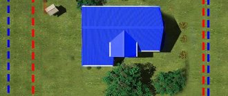
Sample layout of a land plot
With the help of a document such as a map of the location of a land plot on the ground, in accordance with the cadastral plan, it is possible to form an allotment with which it will be possible to carry out any actions that have legal force without hindrance and in full compliance with the law.
That is why, when a package of necessary documentation is being collected, before submitting it to the cadastral engineer, special attention should be paid to those papers, certificates, decisions, etc. that could confirm the legality of the application for the execution of the land plot location plan. It is troublesome and problematic for a non-professional to independently collect a complete set of all papers and check their correctness, for this reason it is more advisable to order a similar service from the appropriate one operating in Penza and the Penza region. The cost of the service is not as high as many people believe, compared to the hassle and risks that you are guaranteed to avoid with our help.
The list of mandatory documentation for preparation includes:
- Cadastral passport for territories that were previously allocated, or for an existing plot, if it is registered. If the plot is registered with the Rosreestr authorities and is assigned the corresponding number, then it must be clearly indicated.
- A written order from the leading person of the authorized body on the preparation of the allocation or formation of an allotment.
- Any documents that could confirm the identity of the person ordering the service.
- If the territory to be transformed was registered on the right of ownership or possession, and there are documents that could confirm its official status, then you need to attach them and all existing related certificates and certificates.
- Documentation that confirms the drawing up of land layout plans or cadastral plans in the past.
The procedure for determining the location of the boundaries of a land plot when clarifying them
The procedure for determining the location of the boundaries of a land plot when clarifying them is established by the Registration Law (Article 10, 22 of the Registration Law), as well as the Requirements for the preparation of a boundary plan (clause 70 of the Requirements, approved by Order of the Ministry of Economic Development of Russia dated December 8, 2015 No. 921).
Thus, in accordance with the Registration Law, when clarifying the boundaries of a land plot, their location is determined based on the information contained in the document confirming the right to the land plot, or, in the absence of such a document, based on the information contained in the documents that determined the location of the boundaries of the land plot during its formation. If there is no information in the documents about the location of the boundaries of the land plot, their location is determined in accordance with the territory surveying project approved in the manner established by the legislation on urban planning activities. In turn, if there is no information about such a land plot in the territory surveying project, its boundaries are the boundaries that have existed on the ground for 15 years or more and are fixed using natural objects or objects of artificial origin that make it possible to determine the location of the boundaries of the land plot (Part 10 of Art. 22 of the Registration Law).
Thus, today the legislator, in order of priority, determines the following methods for establishing the boundaries of land plots:
- establishing boundaries based on information contained in a document confirming the right to a land plot;
- establishing boundaries based on the information contained in the documents that determined the location of the boundaries of the land plot when it was formed;
- establishing boundaries in accordance with the approved territory surveying project;
- establishing boundaries in accordance with actual land use (borders that have existed in the area for 15 years or more and are fixed using natural objects or objects of artificial origin).
Read more…
Natural objects are terrain objects that arose without human participation due to natural phenomena (for example, folds of terrain, edges of ravines and other landscape elements), which make it possible to identify the border of a land plot (including with the help of cartographic material), and objects of artificial origin are objects that located on the surface of the earth, created by human labor, for example, fences, walls of buildings and other structural elements of a delimiting nature.
In the absence of documents specified in the Law on Registration of Real Estate and determining the location of the boundaries of land plots in accordance with actual land use, the cadastral engineer can use the following documents (letter of Rosreestr dated 02.16.2016 No. 19-00221/16):
- maps (plans), which are the cartographic basis of the state real estate cadastre, and (or) photographic plans of the area at a scale of 1:5000 and larger, confirming the actual location of the boundaries of land plots on the ground for 15 years or more (cartographic materials);
- information confirming the location of the land plot, in the form of cartographic materials on a smaller scale;
- land management documentation stored in the state fund of data obtained as a result of land management;
- forest management materials, design documentation of forest areas;
- planning and cartographic materials available in regional authorities of architecture, construction and housing, city, town, and rural local governments;
- documents on territorial planning (including tablets) of municipalities (territorial planning schemes for municipal districts, master plans for settlements, master plans for urban districts);
- projects for organizing and developing the territory of a horticultural partnership;
- situational plans contained in the technical passports of real estate objects located on such land plots.
The list of documents that can be used to clarify the location of land boundaries is quite extensive and is not exhaustive.
In cases where the above documents are used in the preparation of a boundary plan, in the section of the boundary plan “Conclusion of a cadastral engineer”, in the form of a coherent text, a justification should be given for why these particular documents were used, as well as a justification for the location of the specified boundaries of the land plot, containing, for example:
- description of specific objects of artificial and natural origin that secure the boundaries of the land plot on the ground (type of object, for example, a brick fence, building wall, fence, road, ditch, ravine, etc.);
- information substantiating the existence of the boundary of a land plot on an area for 15 years or more (for example, the date of creation of a gardening or vegetable farming partnership, the date of a map (plan), photographic plans of the area, with the use of which the boundaries of the land plot were determined) (clause 70 of the Requirements for the preparation of a boundary plan ).
Incorrect or absent argumentation to justify the location of the boundaries of the land plot in the section “Conclusion of the cadastral engineer” is the reason for Rosreestr to make a decision to suspend the implementation of the state cadastral registration of changes in the USRN information about the land plot on the grounds provided for in clause 7, part 1 of Art. 26 of the Registration Law.
When preparing a boundary plan in connection with clarifying the location of the boundaries of a land plot, the name and details of the documents used to determine the location of the boundaries of the land plots must be indicated in the “Initial Data” section of the boundary plan.
If cartographic materials are used to prepare the boundary plan, including cartographic and geodetic funds, and (or) land management documentation stored in the state fund of data obtained as a result of land management, such documents or copies thereof are not included in the Appendix of the boundary plan .
Copies of other documents used to determine the location of boundaries are subject to inclusion in the Appendix of the boundary plan. In this case, the Appendix may include extracts from these documents or copies of their individual components, including fragments of graphic images containing information (details, marks) about the approval of the document (21, 22, 25 Requirements for the preparation of a boundary plan).
For what reasons may approval of a land plot layout scheme be refused?
For approval, the layout of the land plot on the ground is sent to the executive bodies of state power. You can also contact local government organizations that have the authority to manage territories owned by the municipality. Reasons for refusal to prepare a diagram of the location of a land plot on the cadastral plan may be:
- Inconsistency between the territory plan and its actual location and configuration, with the required document format, or with the requirements for the process itself
- If, when developing a plan for the location of a plot of land, the standards specified in Article 11-9 of the Code of the Russian Federation were violated
- If the layout of the site does not coincide with the territorial planning project, regulations on territories that are especially protected or land management documentation
- If the backlog that will be formed according to the prepared plan is located on the territory of the land that is subject to demarcation
- If a complete or partial coincidence of the plot with the location of the plot that was formed taking into account the previous scheme is revealed if the document is still valid
Simultaneous clarification of the location of the boundaries of adjacent land plots
When carrying out cadastral work to clarify the location of the boundaries of a land plot, intersections of the boundaries of the area being specified with the boundaries of adjacent plots, information about which is included in the Unified State Register, may be identified. Such situations may be related:
- with the presence of a registry error in the USRN information about the location of the border of the adjacent plot common with the land plot being specified, established with sufficient accuracy. In other words, the USRN information about the location of the boundaries of adjacent land plots does not correspond to their actual location on the ground;
- with a discrepancy between the coordinates of characteristic points of the border of an adjacent land plot and the accuracy requirements established by law (Requirements for accuracy and methods for determining the coordinates of characteristic points of the boundaries of a land plot, approved by Order of the Ministry of Economic Development of Russia dated March 1, 2016 No. 90). That is, information about the coordinates of characteristic points of the border of an adjacent plot is determined with an accuracy below the standard for lands of a certain purpose, or information about the standard accuracy is not available in the Unified State Register of Real Estate.
The presence of identified intersections of the boundaries of land plots is the basis for suspending the state cadastral registration of the land plot in respect of which cadastral work was carried out (clause 20, part 1, article 26 of the Registration Law).
Elimination of intersections can be carried out by clarifying the location of the boundaries of adjacent plots simultaneously with clarifying the location of the boundaries of the plot that is the object of cadastral work. In this case, the boundary plan is drawn up in the form of one document, including in connection with the correction of a registry error in the USRN information about the location of the boundaries of adjacent areas (clause 20 of the Requirements for the preparation of a boundary plan).
The procedure for simultaneous clarification of the location of the boundaries of adjacent land plots both in the event that, during cadastral work, a registry error is identified in the USRN information about the location of the border common with the land plot being specified, established with sufficient accuracy, and in the event that the coordinates of the characteristic points of the border of the adjacent land plot are determined with accuracy that does not meet the established accuracy requirements is defined in Part 2 of Article 43 of the Registration Law.
According to the specified procedure, if during state cadastral registration in connection with clarification of the location of part of the boundaries of a land plot, which is at the same time a common (adjacent) part of the boundaries of other plots, and (or) a change in the area of the plot, it is necessary to make changes to the USRN information about land plots adjacent to it , Rosreestr, simultaneously with the implementation of cadastral registration, makes appropriate changes to the information of the Unified State Register of Real Estate on the location of borders (parts of borders) and (if necessary) the area of the specified adjacent land plots.
The application of the provisions of this procedure makes it possible to eliminate not only the reasons that impede the implementation of state cadastral registration of the land plot that is the object of cadastral work, but also to correct registry errors in the USRN records, which leads to an increase in the quality and reliability of the USRN data.
Due to the fact that when making changes to the Unified State Register of Real Estate in the manner established by Part 2 of Article 43 of the Registration Law, criteria for determining the permissible scope of such changes are not established (changes in the “location of the borders and area of an adjacent land plot” or a change in the “location of parts of the borders of an adjacent land plot” plot"), this issue is resolved by the cadastral engineer when performing cadastral work based on the terms of the contract and specific circumstances.
Depending on the specific situation, the cadastral engineer determines the location:
- or individual parts of the border of an adjacent land plot, common with parts of the boundaries of the plot that is the object of cadastral work, including in connection with the correction of a registry error in the location of such parts of the border;
- or the entire border of an adjacent land plot (all characteristic points of its border), including in connection with the correction of a registry error (letter of the Ministry of Economic Development of the Russian Federation dated November 6, 2018 No. 32226-VA/D23i).
When clarifying the location of the boundaries of adjacent plots at the same time as clarifying the location of the boundaries of the plot that is the subject of cadastral work, submission to Rosreestr of an additional (separate) application for amendments to the Unified State Register of Real Estate information about the adjacent land plot is not required.
Read more…
You should also consider:
- If during cadastral work the location of the boundaries of a group of land plots adjacent to each other is clarified or changed, then when submitting documents to Rosreestr by the owner of the land plot - the object of cadastral work or the owner of the land plot in relation to which all plots are adjacent, one application for state cadastral registration is drawn up changes that indicate the cadastral numbers of all land plots, the location of the boundaries of which is simultaneously clarified or changed (with the exception of a forest plot in the case provided for in Part 1 of Article 60. 2 of the Registration Law);
- If during cadastral work it is necessary to change the location of the boundaries of a land plot not adjacent to the object of cadastral work and information about this is included in the boundary plan, then in relation to the non-adjacent land plot it is necessary to submit to Rosreestr the owner of such a land plot a separate application for its cadastral registration in connection with the change basic information about it.
Where can I order a layout plan for a plot of land in Penza?
In order to minimize the likelihood of refusal and avoid possible problems with authorities in the future, it is necessary to strictly follow the procedure for preparing land plot layout plans. It is equally important to collect a complete package of documents, carefully monitoring their legal accuracy and current validity period. Therefore, it is safer and more economical to order a plan for the location of a house on a plot of land from qualified specialists in Penza and the Penza region.
in Penza offers a full range of services in everything related to the preparation of a planning organization scheme for a land plot in a cadastral territory. We guarantee a competent approach to any issue and high-quality implementation of all stages of the procedure. We draw the attention of our clients in Penza: it is not a cadastral engineer who works with us with papers, a project and a scheme, but a qualified land surveyor with extensive experience who is well versed in his business. This means that your documentation will be in good hands, and you will definitely not encounter standard difficulties due to ignorance of the laws.
Our company’s employees are ready to provide free advice and provide prices to each client - you can call us on our hotline or write to our email. All contacts available to customers are listed in the corresponding section of our website.
Cost of preparing the scheme
Preparing a site layout plan is a labor-intensive process, consisting of several stages, therefore the final cost will be determined based on the complexity and duration of each stage. But in any case, we offer the most loyal prices in Penza, with high professionalism, decent quality and speed of work. Today, for legal entities, the cost of the service starts from 20 thousand rubles, without an engineer visiting the site (ordered and paid by agreement), for individuals - from 7.5 thousand rubles to 10 thousand rubles, a visit and consultation of a cadastral specialist will cost five thousand. Preparing a site layout plays a key role in the construction of any facility, so do not take risks and do not try to save money on this important point.