14.09.2018
Arina Zakharenkova
Legal Advisor at IPT Group
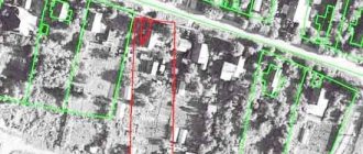
Recently, many land users are faced with the problem of shifting the coordinates of characteristic points of the boundaries of their land plots. Some discover that their properties are located on neighboring plots of land, or even on a different street. Errors can reach hundreds of meters.
Need advice on a topic?
To get a consultation
For example, in the Rostov region, due to a shift in coordinates in a supposedly “free” zone, a new land plot was formed, which on the ground turned out to be included within the boundaries of the previously formed land plot. The dispute between the owners has been pending in court for almost three years, and both sides are suffering large financial losses. Another example: in the Leningrad region, as a result of incorrect determination of coordinates, a plot of 11,000 square meters. m left the lands of undelimited state property, and the local government lost the right to dispose of it. As a result, citizens who could receive the hectares due to them for use cannot exercise their right.
This problem creates reasons for acute conflicts and lengthy proceedings between land users; there are risks of land seizure and various fraudulent schemes to seize it from the owners.
Recalculation of coordinates
Experts note that this situation is often caused by the translation of the description of the location of a land plot from the old coordinate system to a modern unified coordinate system.
Problems associated with the presence of various coordinate systems (including conditional ones), as well as with the recalculation of the coordinates of characteristic points of cadastral division boundaries and information from the state real estate cadastre, including the lack of necessary transition parameters (keys), were addressed in a letter from the Federal State Registration Service , cadastre and cartography dated April 19, 2016 N 19-ref/05229-em/16, in connection with which cadastral engineers and Rosreestr authorities were given appropriate recommendations on how to identify and eliminate them. In the legal field, this situation is called a cadastral (registry) error, the concept and method of resolution of which is contained in Article 61 of the Federal Law “On State Registration of Real Estate”. According to Part 3 of this article, a registry error is subject to correction by decision of the state registrar of rights within five working days from the date of receipt of documents, including in the order of information interaction, indicating the presence of registry errors and containing the information necessary for their correction, or on the basis of the entered into the legal force of a court decision to correct a registry error. It is especially noted that the correction of a registry error is carried out if such a correction does not entail the termination, emergence, or transfer of the registered right to the property. If correction of a registry error may cause harm or violate the legitimate interests of copyright holders or third parties, such correction is made only by court decision (Part 4 of Article 61 of the Federal Law “On State Registration of Real Estate”).
Thus, the land user can initiate the correction of the cadastral error and provide the registration authorities with a boundary plan with updated coordinates of the land plot.
How to resolve the error
An appeal to correct the error must be preceded by a lot of work to study the real and nominal boundaries of adjacent land plots with the involvement of competent lawyers and cadastral engineers who would help find the optimal and least expensive algorithm for solving the problem.
Thus, a shift in the coordinate system of the boundaries of one land plot may lead to its overlap with the boundaries of an adjacent one, as a result of which the coordinates of the latter will also have to be clarified, and so on. That is, the initiative of one land user often affects the interests of all neighbors and problems grow like a snowball. Thus, as a result of recalculation of coordinates in the Novosibirsk region, a citizen’s land plot turned out to be located within the boundaries of different municipalities, which is unacceptable in accordance with paragraph 2 of Article 83 of the Land Code. This problem created obstacles for the local government in exercising its powers to establish the boundaries of the settlement. To get out of the situation, it was necessary to obtain the consent of the owner to correct the registry error, and subsequently to divide the land plot owned by him into two new ones with their boundaries located on the territory of different municipalities, to which the owner objected. The division was achieved only on the basis of a court decision.
Obviously, the work of making changes to information about the coordinates of several adjacent land plots is lengthy and costly: in addition to the cadastral work already carried out by the applicant, a forensic land survey, legal assistance, payment of state fees, and so on may be required. The question arises, who bears these costs?
Main location options
Modern land legislation, in order of priority, identifies the following options for locating civil land plots :
- Based on the data indicated in the document on ownership of the plot.
- According to the information indicated in the documents characterizing the location of the GZU during its formation.
- According to the approved land surveying project.
- Based on actual land use that has existed for 15 or more years in fact.
How to look at the cadastral map?
PKK is the most popular free online service of the Rosreestr portal . You can go to it from the Rosreestr “Services” tab. In order to view the boundaries according to the PKK, you can use the cadastral number and enter it into the search line, after which general information about the land plot will open on the monitor screen in the left corner:
- type;
- status;
- registration address;
- type of property;
- value according to cadastral valuation;
- square;
- data from the specialist who carried out the survey;
- time of entering GKN credentials.
If the information “Without border coordinates” is displayed on the portal screen or the area of the plot is designated as declared, in this case the owner will need to carry out land surveying to clarify the coordinates of the plot.
Read more about how to view the boundaries of a plot using a cadastral map in another article.
How to find out by address?
The second option for establishing boundaries through the PKK is to use its actual address.
To do this, enter the address of the object into the search line of the PKK, for example, the Moscow region; when typing the first letters, the full name of the region appears in the line and you need to confirm it; a district is typed in the same way, for example, Krasnogorsk. Next, the screen will display the boundaries of the plot and complete information for the plot with CN: 50:11:0010417:534, coordinates: 5.813839, 37.359779 and a plot area of 4,162 sq.m.
Additional description of determining the boundaries of a storage area by address can be found in this material.
Who pays?
M. S. Tolstykh points out that as a defendant in a claim to correct a cadastral error in the form of intersection (overlapping) of plot boundaries, the copyright holder of a previously formed land plot with the boundaries of which an intersection has been identified should be involved, and the cadastral registration body should be involved in the consideration of the case as a third party faces.
The cadastral chamber is not the proper defendant in the case, since it is not responsible for the reliability of information, including the coordinates of the turning points of the land plot, submitted for cadastral registration. This position is also supported by judicial practice. Although the owner of the adjacent land plot is brought in as a defendant in court, however, it cannot be his fault for the occurrence of a cadastral error, because he uses the plot within the established boundaries and has title documents. In fact, he only refuses to agree on the change in coordinates, otherwise the boundaries of his site will also shift, and the area may decrease.
In some cases, claims are addressed to cadastral engineers. Part 2 of Article 29.2 of the Federal Law “On the State Real Estate Cadastre” stipulates that losses caused by the actions (inaction) of a cadastral engineer to the customer of cadastral work and (or) third parties are subject to compensation through insurance compensation under the contract of compulsory civil liability insurance of the cadastral engineer. However, it is difficult to prove the existence of a cause-and-effect relationship between the actions of the cadastral engineer in preparing the boundary plan and the costs incurred by the land user to correct the cadastral error - there is practically no positive judicial practice for collecting losses from cadastral engineers.
Thus, the costs of correcting cadastral errors are entirely borne by the owners of land plots in respect of which the Unified State Register contains incorrect information, which is by no means fair. Many authors talk about the problem of the absence of a person to whom claims can be made for the recovery of losses due to the presence of a cadastral error in the Unified State Register of Real Estate. So, Kazanchev I.T. and Dvortsov V.E. indicate the need for a deeper and more systematic regulation of issues of civil liability of cadastral engineers, Antropov D.V. and Skachkova D.I. They also consider it necessary to strengthen the responsibility of cadastral engineers and government bodies for cadastral errors.
Turning points and characteristic points
Each land plot has its own configuration , and, in most cases, it is not a regular polygon. During the formation of a boundary plan, a specialist determines the place where the limiting lines and emphasizing boundaries should pass on the total area of the territory, based on turning points.
They are understood as specific geographical coordinates - a digital designation of the location of land plot points; when they are connected by lines, a closed curve is formed, indicating the boundaries of the site.
Subsequently, a cadastral engineer, with appropriate training, determines the area of the site using a closed area. No one is allowed to move turning points and characteristic points installed by a specialist .
Even if the owners of the site and their neighbors do not agree with the establishment of the boundary and believe that their land rights have been violated, the established coordinates can be challenged either in the government agency that carried out the boundary survey, but no later than within a month, or in court.
Attention! If points are moved without authorization by a person who does not have the authority to do so, he will be brought to administrative responsibility and pay a serious fine.
More information about this topic can be found here.
Complex cadastral works
I believe that the most correct and effective way to correct massive cadastral errors caused by a change in the coordinate system can be comprehensive cadastral work provided for in Chapter 4.1 of the Federal Law “On Cadastral Activities”.
Unfortunately, legal science does not pay enough attention to this institute. Meanwhile, as stated in Part 2 of Article 42.1 of the Federal Law “On Cadastral Activities”, as a result of complex cadastral work, the location of the boundaries of land plots is clarified and registration errors in information about the location of the boundaries of real estate are corrected. The customer for complex cadastral work is the authorized local government body of a municipal district or urban district. Financing for the implementation of complex cadastral works is carried out from the budgets of the constituent entities of the Russian Federation and (or) the budgets of municipal districts, city districts, including from funds allocated to the budgets of the constituent entities of the Russian Federation in the form of subsidies from the federal budget (Article 42.2 of the Federal Law “On cadastral activities"). Thus, comprehensive cadastral work relieves the financial burden from owners of land plots for which the Unified State Register contains incorrect information.
However, the official website of the unified procurement information system contains about ten procurements, the subject of which are complex cadastral works. According to the procurement documentation, the contract price can be about 450,000 - 3,700,000 rubles, and the cost of cadastral work for one land plot is 2,500 - 6,100 rubles. It is clear that, given the widespread lack of budgetary funds, carrying out cadastral work at the expense of local budgets is not a priority; however, similar work costs private individuals five to ten times more. I believe that in the current situation, it is complex cadastral work that should become the main way to correct cadastral errors caused by a change in the coordinate system.
In the meantime, this tool is rarely used by local authorities, land users who are faced with the described problem can be recommended to solve it at the pre-trial stage, to achieve what they want through negotiations with the involvement of consultants and other specialists, without exacerbating the conflict: court proceedings on disputes over the boundaries of land plots, as shown higher, often turn out to be lengthy and much more costly than one might expect at the beginning.
What is the red line?
The red line is considered one of the options for the boundaries of the memory. Despite the fact that it is similar in nature to the state land plot, it is legally stronger, since it includes not only land plots, but entire territorial districts, consisting of a large number of such private plots.
The red line is the main tool of cadastral regulation and is used in construction design. Thanks to this tool, the planning composition of the territory is established: the characteristics of streets, blocks and other municipal spaces.
Helpful information! The red lines distinguish between “existing” and “planned”, and both categories should never be crossed by other boundaries.
Find out more information about the red line on the site diagram in this article.