For the state and its citizens, land is of particular value, therefore all transactions with it, especially sales and purchases, are strictly regulated by law.
Land plots are divided by status, type and purpose, and by law, all information about them is necessarily collected in the Unified State Register of Real Estate (USRN).
However, it happens that a land plot is not registered in the register; this usually concerns previously registered land plots, which can be classified as a special category of property.
Previously registered land plot - what does this status mean, how is it registered as the property of citizens? Find answers to your questions in the article.
The essence of the concept
Information in the cadastre is available on every land plot existing in the Russian Federation. One of the columns is the status of recording the land plot:
- temporary site;
- previously taken into account;
- taken into account;
- archival.
“Previously registered” are all sites created before 2008. This is one of the formulations used to refer to land plots. It was created in the course of systematizing information about all land plots existing on the territory of the Russian Federation. This work has been carried out by the Cadastral Chamber since 2008. When they began to systematize cadastral information, all land plots were a priori called “previously registered.”
This status is still given to plots whose cadastral information lacks any information. In total, each cadastral passport contains:
- registration number and date of registration;
- information about the owner, his rights, establishing documents;
- address of the land plot;
- category and type of intended use;
- dimensions;
- cadastral value of one square meter and the entire plot as a whole.
Some plots do not have adequate reliable data about the owner, others do not have technical information, etc. As soon as the user contacts the cadastral chamber and provides information, the “previously registered” status is removed.
Individual housing construction (individual housing construction, including private household plots)
The owner of a land plot, which is located within the boundaries of a locality or city, has the same rights as city residents who live in houses that are under social and communal services.
The owner is not limited by the size of houses and land plots. But if a citizen has decided to build a cottage, he needs to coordinate the design of the future house with the relevant government agencies. In addition, such plots are subject to much higher taxes than DNP plots .
What plots may be in the status of “previously registered”
Areas formed before 2008:
- owned;
- transferred for long-term lease;
- transferred for perpetual use from the state;
- given on the right of lifelong inheritable ownership.
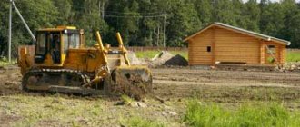
In most cases, the missing information is information about boundaries and land surveying. Previously, land surveying was not given such an important role as it is now. There were no turning points with GPS beacons at all, and the boundaries were determined rather arbitrarily. Now all territories must be re-demarcated, and restoration of borders is a task entrusted to the owners.
How to find out the status of land: two options
To find out the status of your plot, just find it on the public cadastral map. It is posted on the Internet on the official portal of Rosreestr. If the plot is designated as registered without exact boundaries, then it is necessary to carry out land surveying as quickly as possible and provide data to the Cadastral Chamber.
The second option is a reference information service, also online. After entering data about the plot from the database, a response is generated, including whether the boundaries of the requested plot have been clarified.
What is land surveying
Land surveying is currently a mandatory procedure for those areas that are registered without defining boundaries. Correct information in the register provides some guarantee that there will be no problems with the law or unpleasant surprises during the exploitation of the land: for example, it will not suddenly turn out that a house built on the border with a neighboring plot will have to be demolished because it is partially located on someone else’s territory, and etc.
For this purpose, land surveying under Federal Law 218 has been made a mandatory procedure since 2015, without which it is impossible to carry out any civil transaction with the site . When registering most procedures (sale, donation, lease) in Rosreestr, a land surveying act will be required.
Land surveying allows:
- avoid legal difficulties associated with unintentionally occupying someone else's land;
- avoid illegal seizure of your own territory by neighbors, a chance to prove your case in court;
- correctly calculate land tax and current payments, which are calculated based on data on the area of the plot.
The measurement procedure is carried out only on site and only by qualified cadastral engineers. You can find an engineer either among private offers or by contacting Rosreestr. Measurements are carried out in the presence of the owner of the site and the owners of neighboring plots. At the end, all those present put their signatures on the land surveying act.
The act contains data on the shape and boundaries of the site, various measurements, as well as a description of the site: what the land is suitable for, whether there are elevated or wetlands, forest plantations, etc. The characteristic consists of a text and graphic part and gives the utmost insight into a specific land plot.
What is the difference between DNP and individual housing construction?
In some cases, DNP plots may not be located on settlement lands. In this case, the main difference lies in registration in your own home. These lands were intended by legislators for the construction of country houses, where it is not possible to live the whole year. If a citizen builds, for example, a cottage on such a plot, then such construction will be declared illegal.
But some citizens still managed to register in such houses. To do this, they had to go to court and also conduct an examination that confirmed the suitability of the premises for permanent residence. On individual housing construction lands, services to citizens are provided at a more civilized level.
Clarification of territory boundaries
Records in the cadastre about some previously registered land plots may contain insufficient information or be completely absent. If, in fact, a citizen has evidence that the land was in his use, but there is no data about this in the register, a repeat check is required to clarify the boundaries of the allotment. This is necessary when:
- there is no information about the territory in the Cadastre;
- the information contained in the passport is outdated, inaccurate or was received too long ago (15-20 years ago or older).
Possible difficulties
Registration and data correction may be refused. A refusal is always justified. This situation can be caused by mistakes made by the applicant during the application, as well as by the lack of necessary documents.
In addition, problems often arise in cases where the boundaries of adjacent land plots intersect with each other. It is even more difficult to resolve the issue if none of the plots have been entered into the register previously.
If the land plot crosses the border of a plot owned by the municipality, then such land may become unsuitable for land surveying and other work for registration. In this case, you will have to resolve the issue with the relevant department of the local administration.
How civil transactions are carried out with previously registered plots
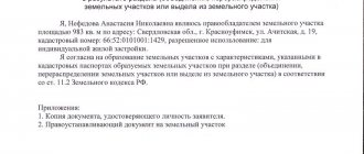
Sale, donation, exchange - procedures during registration of which an employee of Rosreestr will definitely require:
- a fresh extract from the Unified State Register of Real Estate (even if there is an outdated title document - a certificate of ownership, “greenback”);
- identification;
- land surveying act and technical plan.
It is recommended to provide a boundary plan to make clarifications in the cadastral passport before a sale or exchange transaction is scheduled. The fact is that it is impossible to obtain an extract from the Unified State Register for a previously registered plot without clarifying the details of its cadastral data. In order not to delay or complicate the sale procedure, it is better to prepare documentation for the plot in advance
.
Stages of selling a previously registered plot (possible only in the “registered” status):
- drawing up a preliminary agreement;
- receiving a deposit (up to 10% of the purchase price of the site) with the execution of a receipt and agreement;
- signing the final purchase and sale agreement (number of copies - according to the number of participants in the transaction plus one for registration in Rosreestr);
- making changes to the Cadastral passport by registering an agreement.
No special special procedures will be required if information about a previously registered land plot was rechecked before the date of sale was set, and its status changed to “registered”.
Clarification of difficult points
Violation of the type of permitted use of land is a difficult point to determine. In judicial practice there is no general view of such a violation, but the difference between them is huge.
In some courts, the type of permitted use of the plot is considered as compliance with the declared directives. A different approach does not consider changing the VRI as going beyond the intended purpose; accordingly, there can be no talk of legal liability.
There are a lot of contradictions in judicial practice on issues of violation of the intended use of land. Different authorities may make diametrically different decisions on the same issue. Therefore, in order for the court to always be on the side of the owner, legal scholars recommend seeking the services of competent specialists in the field of land law.
What is the difference between a site category and a RVI?
The legislation does not provide a clear interpretation of the permitted type of land use. Therefore, the concept is taken from the existing legislative framework. RVI is a characteristic of an allotment based on the zoning of territorial boundaries with a designated purpose. That is, the permitted type of use determines the functional purpose and status of land plots. For example, for the construction of multi-storey buildings.
The purpose of creating a classification of territories is to preserve the original properties of the land. The concept of “site category” has a fairly broad meaning, and RVI is of a clarifying nature. Let’s take as an example an allotment in a gardening non-profit partnership, and it will have the following characteristic data:
- Category – conducting agricultural activities.
- RVI (what you can do on the site) - plant a garden, vegetable garden.
- Basis - the land is registered as private property or rented by a specific person.
There are 3 types of permissible use of plots - main, conditionally permitted, auxiliary. The last variety is used simultaneously with the first and second types. If the use of the plot is conditionally permitted, consent will be required from the local administration. To do this, mandatory hearings are held, after which a decision will be made.
The main species are determined by the new RVI classifier. It not only streamlined the presentation of information, but also introduced new subtypes. The status of the site may be as follows: construction of garages, low-rise apartment development, higher educational institutions of various specialized levels. In addition, land is provided for equipment of meteorological services, construction of schools and kindergartens.
Time and cost of preparing a previously registered plot for sale
The land surveying procedure takes, perhaps, the lion's share of time. To carry it out, you will need to agree on the day with your neighbors, so the procedure from the day of initiation to the receipt of the document can take 4-5 weeks. On average it is three weeks. Neighbors must be notified at least 10 days before the expected date of work on the site. Then some time is given to the cadastral engineer to prepare the survey report.
The procedure is always paid, the amount depends on many parameters, primarily on the region in which the plot is located. Dimensions, the need to install GPS turning points and other nuances affect the final cost.
Registration of a boundary plan with Rosreestr takes 10-12 days. The owner must come with documents for the land and a plan, submit it all for review, and then after a while, receive an extract from the Unified State Register of Real Estate with updated information. Cost – from 400 rubles.
Further, the timing of the sale depends on the buyer and seller. However, registration of the purchase and sale agreement and the new owner also takes about 10 days. State duty – from 350 rubles.