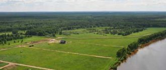
One of the problems of landowners is the legalization of additional land area occupied by public lands. Owners often cross the established boundaries of their own land and use additional acres for economic purposes. In Moscow and the Moscow region, the legal transfer of a land plot to private ownership can be performed in our organization.
Legalization of increasing the boundaries of the site
When can land be purchased?
It is possible to legitimize an increase in a plot in the case where the selected land is not privately owned and does not belong to the territory of parks, reserves and protected areas. Before you begin to legitimize the occupied territory, you should make sure that other landowners, organizations, and commercial companies will not lay claim to it.
The purchase of state land is carried out according to the procedure agreed upon by the Land Code of the Russian Federation. A plot cannot be annexed if it is of strategic importance or if the land has already been planned for commercial activities. Information about the possible use of such a site is available from local authorities.
Application for approval of the scheme
application for approval of the layout of the land plot on the cadastral plan of the territory.
Attention! If the site is expanded at the expense of municipal land, then an additional payment must be made to the local budget for such an operation. The amount of payment and the timing of its payment will be announced upon submission of the application.
How many acres can be added to a plot of land? What is a cut-in?
How is land added to an existing plot? In 2014, a new Federal regulation was adopted, which introduced some changes to the Land Code. According to it, individuals who own land have the right to increase their size by redistributing land plots.
The redistribution is called redistribution
How can additional acres of land be added to the site? In practice, redistribution is called redistribution. By adding to it we mean the ability of an individual who owns a plot to increase its size by adding additional land to it that is located nearby (bordering it).
Trimming requires a certain procedure and collection of necessary documents, which will be discussed below. It ends with the signing of a special agreement with the municipal body (which will be discussed below).
You need to remember that cutting is not a dacha amnesty. In the first case, a person can increase his allotment at the expense of free land that borders his plot.
In the second case, the citizen is given the opportunity, bypassing fines, to legitimize the territory that was seized without any documents (the so-called land squatting).
What laws govern
The procedure for legalizing new plots is described in Chapter. V.4 Land Code of the Russian Federation. The law operates with the concepts of “acquisition” and “land redistribution”, so it is important to use these terms in the correct context.
- Land redistribution. This is the name of the method of forming a new site. In this case, the original site ceases to exist. The formed plot has a different area, and the rights to this land are established on the basis of an agreement between landowners and local authorities.
- Extension is an increase in a private land plot by adding state (municipal) land to the area.
Registration of ownership rights to the extension and the buildings on it are currently taking place without court intervention, using a simplified procedure. The applicant prepares documents and submits them to Rosreestr. If the application procedure has been followed, after 30 days the landowner receives permission and includes new square meters within the boundaries of his own land plot.
The land is transferred to the ownership of the developer if the building complies with the standards set out in the Town Planning Code. If a landowner illegally increased his boundaries and failed to carry out land surveying, he faces an administrative fine of up to 200 thousand rubles. All buildings on such a plot of land are illegal and must be demolished.
Practical features
In practice, an increase in area is most often carried out through a redistribution procedure.
The allotment is increased at the expense of nearby territories that belong to the state or municipal fund. In this case, you need to contact the owner. Most often this is a municipality. In most cases, he will agree to redistribution if the site is not used in practice and does not have any restrictions.
It is important that the redistribution is carried out free of charge. In essence, citizens simply annex plots that are nearby and not used by anyone.
If conflicts arise, for example, with neighbors who do not want to sign the agreement, you can try to resolve it in court. This is done through going to court, by filing a statement of claim.
Legalization procedure
The Land Code of the Russian Federation allows an increase in the area of land due to the addition of lands that are in municipal or state ownership. The decision on land allocation is made at the level of local governments.
The application is submitted by the owner of the site or his authorized representative. In this case, the resulting size should not exceed the established limits. For Moscow and Moscow region, the maximum parameters of the site for individual housing construction are within the range of 6-15 acres. You can find out the exact dimensions in the land use regulations (land use rules) of your municipal area.
Attention! It is not permitted to increase land plots at the expense of roads, communication structures, or other structures necessary for the normal functioning of the area. The ban also applies to forest and coastal areas.
The added area should not exceed 10% of the area of the main site. If the annexed land is larger, or its total area exceeds the established boundaries, then a new plot is formed and purchased at the stated cadastral value.
You can begin to legalize the cutting only after registering the boundaries of the existing site. To do this, it is necessary to carry out land surveying and register the land in the cadastral register. A package of documents is submitted to Rosreestr:
- civil passport of the owner of the plot;
- boundary plan of the site;
- an act certifying the rights to this site;
- receipt of payment of duty.
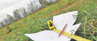
Marking the boundaries of the site for land surveying
How to officially legitimize the expansion?
First of all, it is necessary to obtain ownership of the main plot, if this has not been done previously. It is possible to legalize an increase in the area of a land plot after setting boundaries and registering the main plot with cadastral registration. According to a simplified procedure, the following documents are submitted to Rosreestr:
- Passport;
- Statement of the established form;
- Cadastral passport for the plot;
- Document of title on the basis of which property is acquired (sale and purchase agreement, privatization deed, deed of gift, certificate of inheritance);
- Receipt for payment of state duty.
After registration, an extract from the Unified State Register is issued, which shows the ownership of a certain plot.
Geodetic works
After receiving the property documents for the main plot, you need to carry out land surveying. For this purpose, a licensed cadastral engineer or employees of a geodetic company are invited. As a result, the owner receives a land surveying project and a layout plan for the expanded site.
The specialist must make sure that there are no claims to the territory by third parties and that it is not owned by another landowner. Measurements are taken and boundaries are set so that there is no overlap with neighbors' territory.
It is important to make sure that there is no conflict or disagreement on their part regarding the passage of borders. As a result, a boundary plan and an act of completion of work are prepared, in which the owners of adjacent plots, if any, must sign. If everything is in order, you can proceed with further paperwork.
Application to the administration
The owner must contact the administration responsible for the distribution of land in his area. You must submit an application and attach title documents for your site and a boundary plan. If the application is filled out incorrectly, does not correspond to information from the documents, or is submitted to the wrong authority, it will be returned within 10 days with an indication of the reason. If everything is correct, the issue of land allocation is considered within 30 days.
During this time, the municipality makes a decision on approving the site layout. The owner receives consent to conclude an agreement on the redistribution of plots in accordance with the approved boundary plan. Before the expiration of the 30-day period, a redistribution agreement is signed.
Changing the boundaries of the site
Next, the boundaries are clarified, for which it is necessary to complete the registration steps. Otherwise, at the official level, it will be impossible to be considered the owner and fully manage the new territory. To do this, the following documents are submitted to Rosreestr:
- Statement;
- Extract from the Unified State Register of Real Estate;
- Title document for land;
- Passport;
- Land surveying project;
- Layout of the expanded section;
- Positive decision of the administration to allocate a new territory.
Upon completion of the work, the applicant receives an extract from the Unified State Register of Real Estate with the new configuration of the site and area. In fact, you have to carry out the entire range of work at your own expense, including cadastral work. This is convenient for state and municipal authorities, since they do not have to spend budget funds, and taxes are received into the budget.
Payment amount
According to Art. 39.28 of the Land Code of the Russian Federation, the amount of payment for the added plot is established by state, regional or municipal authorities. It depends on the territory. To calculate the full payment, the indicators of cadastral value, total area and connection payment as a percentage of the cost are used.
You can find out the cadastral value yourself if the plot is in the real estate register. To do this, you will need a conditional or cadastral number and the exact address of the location. If you don’t have time to search for a site yourself in the database, you can send an electronic request to Rosreestr. In most cases, a small part of the unused plot is added, so about 15% of its cadastral value is paid.
Please note that payment for the increase in the plot is not allowed in installments or with a deferment. It is important to apply if you already have funds to purchase the plot.
Costs are significantly lower than market value for the following reasons:
- The site is usually expanded due to ownerless land;
- The occupied territory is fenced off long before official registration, which is actually considered squatting;
- Cadastral valuation is carried out according to a special algorithm, as a result of which the value is lower than the market value.
Despite the low cost, in many cases you have to pay for cadastral work. The cadastral engineer prepares a conclusion that may cost more than the attached plot.
Preparing the circuit
The work is carried out in three stages:
- preparatory: work is carried out with legal acts, extracts from registers of owners are requested, zoning and inventory data are clarified;
- field: an engineer goes to the site, a geodetic survey of the area is carried out, boundaries are determined, and they are agreed upon with neighboring owners;
- office: final work is underway to determine the area of the site and existing boundaries.
A surveyor conducts a survey.
During the work process, a specialist from a surveying company must make sure that the land being added:
- is not privately or communally owned;
- does not contain communication trenches and structures;
- is not commercially owned;
- is of no interest to third parties.
The result of the cadastral engineer’s work is drawing up a diagram of the location of the site on the cadastral plan of the territory.
Boundary Increasing Scheme
Submitting documents to the administration
After receiving the location plan, the owner of the site contacts the district administration with a package of documents. Submit documents to the authority to which the main site belongs territorially. An incorrectly completed package will be returned within ten days, indicating the reason for refusal to review. The state duty is not refunded. If everything is done correctly, the administration considers the issue within thirty days and reports its agreement (or disagreement) to expand the boundaries.
After receiving approval from local authorities, the boundaries should be clarified, that is, a new boundary plan should be prepared, otherwise the new territory will not be officially registered. To complete the registration, an extract with the decision of the local council is added to the package of documents, and all papers are sent to Rosreestr. The issue is considered for 30 days. The owner is issued an extract from Rosreestr.
Cadastral work for cutting off a plot
If the application is satisfied, an agreement will be drawn up between the owner and the local authority. With this document you can contact a cadastral engineer and undergo land surveying. The essence of this procedure is to establish characteristic points of the boundaries of the future single site.
Cadastral work is carried out using high-precision equipment, so the engineer will clearly determine whether the annexed territory does not exceed 10% of the area of the original site . After surveying, an act of coordination of boundaries with the owners of neighboring plots will be prepared. 30 days are given for consideration and signing of this act. If the act is signed without objection, you can contact Rosreestr for cadastral registration and registration of rights.
Problems may arise when agreeing on the boundaries of the act. Owners of adjacent plots may themselves express interest in the disputed territory, or object to the boundary points. To resolve disagreements, the cadastral engineer is obliged to carry out repeated boundary work and re-submit the act for approval. If in this case a refusal of approval is expressed, the boundaries can only be approved through the court.
Terms and payment
The cost of legalizing cutting is regulated by Art. 39.28 of the Land Code. In some cases, trimming is provided free of charge. This applies to buildings and structures belonging to:
- citizens who have already used the site for 5 years in accordance with the permits provided;
- religious organizations;
- citizens with many children;
- certain categories of individuals, if provided for by the laws of the Russian Federation.
The procedure for registering new borders takes about two months. But if refusals are issued due to incorrectly completed documents, this period will increase by six months.
Costs for legalizing land are set by local authorities and depend on the region where the site is located. When calculating the cost of registration, the following are taken into account:
- cadastral value of the main plot;
- total area of the new territory;
- connection fee for cutting.
Attention: payment for land legalization is a one-time payment. Payments in installments are not allowed.
Most often, the connection fee is about 15% of the cost of the main site. But this amount will be increased due to the payment for the services of a cadastral engineer.
How to calculate the cost of cutting land
Law No. 150-FZ does not provide for charging a fee if the cutting is carried out within 10% of the area of the original site. In essence, the state encourages owners to identify and secure rights to ownerless plots or unallocated lands of the municipal fund. For other additional options (contracts, agreements), the amount of the fee can be determined by agreement of the parties.
You won’t have to pay for cadastral registration either, since this municipal service is provided free of charge . The cost of cadastral works (surveying) is determined by a contract with a cadastral engineer. Prices depend on the total area of the borders, the remoteness of the site, and other factors.
Reasons for refusal
At the stage of accepting documents, the administration rarely refuses to review them. Reasons for refusal may arise later. The owner should monitor the registrar's decision-making process and provide additional information in a timely manner.
Legalization of the new boundaries of the site will be refused due to:
- discrepancies between the information from the application and the submitted documents;
- lack of consent of neighbors and other interested parties;
- putting a new site up for auction;
- transfer of cuttings to commercial property on a leasehold basis;
- overestimated final area of the site
and other reasons that will accompany the refusal. If there is a discrepancy between the data in the documents, the situation can be corrected, and the application for joining the addition can be sent for registration again. In this case, a repeated payment of the state duty is provided.
Important: Rosreestr will not legalize new boundaries if data about the site has not been registered. The registration procedure should be carried out as required by law, and it should begin with clarification of the data in the cadastral register. Only after the area being cut is registered is it possible to join it to the general territory.
Refusal to redistribute land
- The application was submitted for plots not subject to redistribution.
- There is no written consent from the land users of the original land plot, that is, if the plot is leased, then before applying for redistribution of land, it is necessary to obtain written consent from the tenant. If there is no such encumbrance, this paper is not required.
- On the land plot being cut off there is a building or unfinished construction owned by third parties.
- The land being cut is withdrawn from circulation or has limited rights of use. It will definitely not be possible to legalize such an addition to a land plot. To find out, you will need to familiarize yourself with the list of lands. Removed from use or having restrictions. You can check this using a public cadastral map, which is publicly available on the Internet. There are very few cases of such land adjoining, so this option of refusal occurs extremely rarely.
- The cutting of a plot cannot be done at the expense of land plots and lands reserved for state and municipal needs. Such information should also be reflected on the cadastral map of a given municipality. But relying only on open Rosreestr data located on the Internet is not the best option. Still, it makes sense to make a corresponding request to the administration of the locality.
- Redistribution cannot be carried out at the expense of lands put up for auction or at the expense of a site in respect of which a decision on preliminary approval has been made, while the two-year limitation period after the adoption of this decision has not yet expired. Information about this can be seen on the website torgi.gov.ru or using Internet search engines.
- It is impossible to cut areas for which preliminary approval has already been submitted and the decision to refuse this procedure has not yet been made. That is, in the event that the requested plot of land is already undergoing a lease procedure.
- The area of the cut area should not exceed the permissible limits. The new site should not be larger than prescribed by the rules of the given territory. You can find land use and development rules on the administration website.
- In the event that a new land plot is formed at the expense of lands from which it is possible to form an independent land plot without violating the requirements prescribed in the legislation of the Russian Federation, the addition will be denied. If the cut area corresponds in size to the minimum dimensions of an independent area, the procedure may also be refused. Since this plot can become an independent unit for full use. To avoid refusal for this reason, you can increase the land plot by cutting off only part of this plot; after some time, the procedure can be repeated. But cutting should not be carried out in the form of wedging into a new area.
- If the boundary of the cut area is not specified, the procedure will also be refused. Many unused areas have a previously taken into account status. In this case, before cutting the plot, it will be necessary to carry out land surveying to identify the exact boundaries of the land plot.
- Violation of the boundaries of the site when drawing up the diagram is a good reason for refusing to carry out the extension.
- The scheme should not be carried out in violation, otherwise this will also become the reason for refusal to increase the site.
- In the event that you plan to cut a plot, there should not be an approved land surveying project in this area. It won't be difficult to check this.
Why is it profitable for the administration to sell the land?
The transfer of land into private ownership is beneficial to the authorities themselves. This:
- reducing the cost of servicing municipal and state lands;
- increase in revenues to the local budget due to prices for registration of work and payment of state duties;
- increased payment of land tax due to the increased cost of the site.
For the owner, legalization of land means the subsequent legalization of private houses, as well as all household and outbuildings erected on the cut-off plot.
It is important to remember that the simplified registration procedure is limited in time. Therefore, we should hurry with the legalization of borders, since after the amnesty is lifted, this problem can only be solved through the courts.