A cadastral number must be assigned to all real estate objects, without exception , for which the registration procedure in the state real estate cadastre has been completed.
This requirement is established by Art. 5 Federal Law No. 221 “On the State Real Estate Cadastre”, adopted on July 24, 2007. It also applies to land plots.
The cadastral number is a sequence consisting of 19 digits.
It consists of 4 parts, which are separated from each other by colons. Each of them has a specific meaning: these are the numbers of the district, district, quarter and, finally, the land plot itself.
Using this code, you can find out all the most important information regarding a specific piece of land, including its quantitative and qualitative characteristics. Also, this detail can serve as one of the ways to confirm the owner’s ownership of the land.
We will look at where to get the cadastral number of a land plot if it is not available in this article.
Why do you need to get it?
The need to obtain a cadastral number for a land plot is due to the fact that:
- The presence of such a number with the owner serves as confirmation of the fact that the site is in his ownership . This makes him the full owner of his land and gives him the legal right to dispose of it at his own discretion: a purchase and sale transaction can be made with the plot, gifted to another person or bequeathed to heirs.
- It must be presented to the Federal Tax Service in order for land tax to be calculated correctly .
- The cadastral number is a means of identifying a land plot . Knowing it, an interested citizen will be able to accurately determine its size, boundaries, location, as well as the quality of the lands within the site and their purpose.
It is still possible to try to dispose of a plot that is not registered in the cadastral register, but this is not in the interests of either party to the transaction.
In this case, the potential buyer loses interest in purchasing it, since he cannot receive official confirmation of information regarding the most important characteristics of the site.
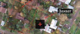
Moreover, the absence of a cadastral number may lead to disputes regarding the determination of the owner of land ownership , and municipal authorities in such a situation have the right to raise the question of recognizing it as illegally seized.
In connection with these reasons, the owner of a plot of land who has not yet received a cadastral number for it should be interested in doing this as soon as possible.
Why is it necessary to obtain a CN?
The presence of a cadastral number indicates the fact of its inclusion in cadastral records. Accordingly, its absence indicates the opposite. This state of affairs may affect the conditions for concluding a property transaction. The buyer can significantly reduce the price offered for such a plot, as well as refuse to purchase it. There is a reason for this - no one wants to risk the money invested in the purchase of a storage device.
It should be noted that such a risk is acceptable. Depending on the legal capacity of the site and the extent to which it is supported by title documentation, the right of ownership may be challenged by third parties or the administration of the locality. The site may be classified as illegally seized, in accordance with Article 7.1 of the Code of Administrative Offenses of the Russian Federation. On this basis, it is permissible to seize it from a dubious copyright holder.
At the same time, a person who owns a plot without securing ownership rights, which is officially certified only by Rosreestr, will not be able to substantiate a legal precedent for the emergence of the right.
A cadastral number should be assigned as soon as possible if it is discovered that it is missing . This will avoid problems associated with a weak legal basis for disposing of the site. Actions should be taken before a precedent arises for claims to the site by third parties or the administration.
Reasons for receiving
The basis can be considered the actual ownership of the site, which is motivated by one or another legal precedent. The exception is illegally seized municipal plots of land, the disposal of which has not received any official sanctions. But it is also permissible to take some forms of legalization of use in their direction.
Legal precedents giving the right of actual possession may be as follows:
- The allocation of land was carried out back in Soviet times to persons who had died by that time, having lost documentation and not having re-registered the allotment.
- The plot was sold before the Land Legislation of the Russian Federation came into force, without re-registration.
- Passed by inheritance as a result of an informal oral order of the deceased.
- The administration provided verbal permission to use the lands.
- These and similar precedents allow for the official registration of land, subject to the restoration of legal capacity.
In other cases, the official basis for assigning a cadastral number to a property is :
- title document for the allocation of land plots;
- certificate of inheritance;
- act of the administrative commission on permission to use;
- extract from the court decision.
With a civil passport and one of the legal grounds, citizens have the right to apply to Rosreestr.
Reasons for receiving
The general basis in all cases should be the fact of ownership of land if it was obtained legally .
If the land was acquired in violation of the procedures established by law, or, more simply put, appropriated, the citizen who illegally owns it cannot, except in cases established by the legislator, register it in his name and become the full owner.
to legalize a land plot and obtain a cadastral number for it based on the right of actual ownership in a situation where:
- the land was allocated for use during the years of the USSR to persons who are no longer alive at the moment, the documents for it were lost, and the procedure for re-registration of the allotment was never carried out;
- land ownership was purchased before the current legislation came into force, but there was no re-registration;
- the plot was received as if by inheritance, but this is not documented (for example, the deceased expressed his will orally);
- The settlement administration agreed to use the plot.
In the listed cases, municipal authorities often meet the needs of persons who own plots of land and use them for their own personal purposes, if this does not contradict the purpose of the land.
If the land has actually been in use for 15 years and no one has made any claims to its ownership , there should be no problems with its legalization.
In all other situations, the grounds for assigning a number to a real estate object should be considered:
- execution of a document that confirms a citizen’s rights to land;
- availability of a certificate confirming the right to inherit;
- issuance by the administrative commission of an act giving permission to use the property;
- changing the purpose of an object when land ownership should be used for other purposes;
- a court decision that was made in favor of the applicant (his extract will be required).
Nuances of assigning a cadastral number to a land plot
Only adult citizens who are land owners or land users can obtain a cadastral number. You can register both your own land and those owned by a person on the basis of a long-term lease, the right of perpetual use or the right of lifelong inheritable possession.
You can also assign a cadastral number to a newly formed plot during division or merger. Registration and re-registration of rights is the final stage of the procedure.
If the land plot was received by inheritance, then there is no need to assign it a new cadastral number. Along with the plot, all documents are transferred to the new owner, including the cadastral passport, which contains a unique number.
You cannot assign a cadastral number to the following categories of land:
- lands intended for use by the Russian security services;
- lands of the Armed Forces of the Russian Federation;
- territories of nature reserves or natural-historical monuments;
- areas that are in the state reserve;
- lands withdrawn from circulation;
- water or forest lands;
- lands for which privatization is impossible.
You can find out which category of land your plot belongs to by contacting Rosreestr or the MFC. To do this, you will need to write an application and pay a state fee of 200 rubles. An extract with the necessary information will be ready in 5-7 business days.
It is impossible to register ownership of a land plot or make any transaction in relation to an allotment without assigning a cadastral number.
How is KN assigned?
These rules are defined in Section 2 of Order No. 877 of the Ministry of Economic Development dated November 24, 2015.
Let's take a closer look at them.
- A cadastral number (hereinafter - CN) must be assigned to all plots, information about which is subject to inclusion in the Unified State Register of Real Estate (USRN): in the case of the formation of a new plot , for example, when it was formed into a single whole from other plots; in the process of adding data about a previously registered site to the Unified State Register .
- CN is given to a land plot in the cadastral quarter within which it is completely located . With a large area of land ownership, it can occupy several cadastral districts. In such a situation, the cadastral number is assigned in the quarter with the accounting number “000”. The boundaries of this quarter must coincide with the boundaries of the All-Russian cadastral district. When a property is located in several cadastral districts (belonging to one cadastral district) or in several blocks of one cadastral district, it will be allocated a CN in a quarter that has the serial number “0”, the boundaries of which in this case will coincide with the boundaries of the district or district.
- If, during the process of inclusion in the Unified State Register, it is impossible to establish the cadastral quarter or area of location of an already registered object, it will be assigned a number in the quarter with the number “0”, the boundaries of which coincide with the boundaries of this area or district.
- The cadastral number must be written as decimal numbers consisting of Arabic numerals. It consists of groups of numbers separated by a colon, indicating the registration number of the cadastral quarter and the serial number of the object located on its territory.
- If a site has been deregistered, its CN cannot be used again to assign it to another object .
- Once a cadastral number has been assigned to a land plot in accordance with established rules, it is not subject to change, even in cases of changing the cadastral division or assigning a number in a quarter in which it is not located.
- If the rules for registering a CN regarding the meaning and recording of its numbers and dividing marks are violated, and also when it turns out that another object has the same number, it is assigned a new number, which must be the next in order within the cadastral quarter.
Receipt procedure
Documentation
To obtain a cadastral number, you first need to prepare the necessary documents :
- a certificate confirming land ownership or an extract from the Unified State Register of Real Estate;
- a document that is the basis for acquiring the right to use real estate (this can be a purchase and sale or lease agreement, a certificate of inheritance, a deed of gift);
- if the land ownership is located on the territory of a gardening association, a certificate of membership in this association will be required;
- if you need to rent an object from the state or municipality, you must obtain the written consent of the municipality and other tenants, if any;
- when one of the owners is a minor, it may be necessary to obtain the consent of the guardianship authority;
- a duly certified certificate of assignment of an identification code;
- technical plan;
- boundary plan;
- identification document of the interested citizen (civil passport.
The technical plan and the surveying procedure can be ordered from a geodetic company , making sure that such work is permitted by its license.
In certain situations, the owner of the land does not have the opportunity to act personally for himself. In such cases, according to the described procedure, a representative may act on his behalf, for whom it is necessary to issue a power of attorney certified by a notary.
Where is it issued?
A cadastral number can be obtained by submitting a package of documents to the local branch of Rosreestr or to the MFC .
A prerequisite is preliminary land surveying; to carry out this procedure, you will need to contact a geodetic company.
An agency official will ask the applicant to complete an application, also called a request.
Its form can be downloaded by following the link https://mfc-gosuslugi.ru/attachments/article/15/f-pril-1.doc.
Then the citizen must be given a receipt for payment of the state duty. Its size today is 200 rubles .
An employee of the institution takes the documents, in return for which he gives the applicant a receipt. It must contain a list of all transferred papers, as well as the date when you can pick up the extract with the cadastral number. If you submit an application through the MFC, you can receive the finished document there.
As of 2021, cadastral passports are no longer issued as they have been abolished. Now the applicant is given a single extract from Rosreestr.
Deadlines for preparing an extract
If there are no errors or inaccuracies in the documents, the extract will be made within 21 working days . If inconsistencies are found in the papers, this can greatly delay the procedure.
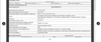
The finished extract with the cadastral number looks like this:
Online issuance
Today such an opportunity exists. To use it, you need to go to the Rosreestr website by entering https://www.rosreestr.ru in the address bar of your browser, and then going to the “Individuals” section (for citizens).
In the window that opens, on the right we find the link “State cadastral registration” and follow it.
In the form that opens, mark the items we need and move on, following the instructions displayed on the screen.
After completing all the steps (there are 4 in total), an application will be submitted to register the land plot for cadastral registration.
When the documents are ready, they can be obtained at the applicant’s choice:
- as a link to an electronic document;
- in the form of a regular paper document (in the division of the body for registration of rights, in the MFC, or by sending by mail).
You can get an extract for an already registered object by selecting the corresponding command on the right side of the window in the previous screenshot (it is the top one in the column). A page will open with a form to fill out, where you must enter the relevant information.
Next, you should go through 3 more steps, following the instructions.
After completing the form and confirming the entered information, the request is sent for processing.
Depending on the user's choice, the finished statement will be received :
- as a link to an electronic document;
- to the e-mail address.


