The need to survey a garden plot is described in Federal Law No. 221 “On Cadastral Activities” and No. 447, where changes were made to the first legal act.
Both documents regulate the procedure for determining boundaries on sites.
Since not all citizens are ready to carry out a long-term and expensive land surveying procedure, the State Duma adopted a law that was popularly called the “dacha amnesty.”
What is land surveying?
Land surveying is the establishment of the boundaries of land owned by a citizen and the drawing up of its schematic plan. The process is integrally connected with cadastral activities.
IMPORTANT! The delimitation of plots requires the consent of neighbors and permission from the BTI.
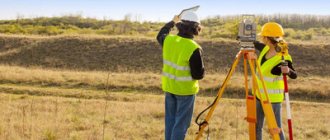
Surveyors or cadastral engineers are invited to carry out measurements at the request of the owner. The main work is carried out directly on the site. The specialist marks its boundaries with identification marks: pegs and posts. Measurements are taken to the nearest centimeter.
What does the procedure consist of?
The procedure for land surveying a summer cottage in 2021 implies the following order of work:
- Preparatory stage. Before starting work, a thorough study of the technical documentation regarding the site, as well as its special topographical signs and geodesy boundaries, is carried out.
- A plan for carrying out boundary work is being developed. After approval of the plan, the owner is informed of the date and time of the visit of cadastral engineers.
- After this, neighbors are also notified about the upcoming procedure.
- Upon arrival, cadastral engineers establish the coordinates of the land plot, determine its exact area, and also prepare a drawing of the plot.
- If everything is done correctly and fully, the results of the work are agreed upon with the city municipal service.
After confirmation from the administration, the final documentation of the site plan and boundary work takes place.
In 2021, changes were made to carry out the land surveying procedure Source yandex.net
Why is land surveying necessary?
Owners are in no hurry to officially mark the boundaries of their land plots due to the high cost of the service and the length of the process. But if it is necessary to carry out legal transactions with an object, this procedure cannot be avoided.
IMPORTANT! The purpose of surveying a garden plot is to determine its exact dimensions and boundaries. The plan is required to register ownership in the Unified State Register and obtain a cadastral passport.
Determining the boundaries of the dacha territory is mandatory when:
- concluding a sales agreement;
- rental transaction;
- gratuitous transfer of property rights;
- the beginning of capital construction (houses, cottages, bathhouses, extensions);
- the emergence of land disputes with neighbors;
- dividing or merging territories of summer cottages;
- removal of part of the land from collective ownership.
Owners also initiate mandatory land surveying when erecting a fence around the perimeter of the plot.
On the public cadastral map
So, the easiest way is to check the land survey on a public cadastral map by cadastral number or address of the land plot.
For comparison, let’s take 2 neighboring land plots with cadastral numbers 66:41:0520019:12, 66:41:0520019:13 and compare them for the presence of land surveying (established boundaries).
Step-by-step instruction:
- We open the official website of the public cadastral map: https://pkk5.rosreestr.ru
- Find the “Search” icon and click on it.
- Enter the cadastral number and click “Find”
4. Information about the land plot will open. We are only interested in the line about the area.
- A plot of land with cadastral number 66:41:0520019:12 has a specified area , that is, an exact one.
- The neighboring land plot with cadastral number 66:41:0520019:13 has a declared area , that is, an approximate one.
Conclusion:
The land plot with the specified area is demarcated.
The land plot with the declared area is not demarcated.
————————
Tip: Please keep in mind that the information on the public cadastral map is not always up to date. Therefore, I advise you to check the information in the current extract from the Unified State Register of Real Estate (USRN).
————————
In what cases is land surveying not required?
Order of the Government of the Russian Federation No. 2236-r dated December 1, 2012 obligated the owners to determine the boundaries by 2021. Citizens who have not done this before the specified period cannot make transactions with real estate without mandatory land surveying. In other cases, the procedure can be postponed or abandoned altogether. These facts include:
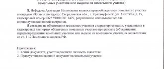
- Privatized objects under the dacha amnesty. In this case, it is important to prove the absence of controversial issues with neighbors regarding the boundaries of the land and provide the corresponding agreement to the cadastral chamber. Information about the land contained in the certificate of ownership must be identical to that in the agreement with neighbors.
- Decoration of a house built on the territory. In such a case, separating the allotment from adjacent objects is not necessary. You just need to provide a cadastral passport, a land plan and documents confirming the legality of the construction of residential real estate.
ADVICE! In case of controversial issues with neighbors, land surveying will help resolve the conflict.
Video description
Legal advice on land surveying issues in this video:
Changes in legislation
Initially, all cadastral work was regulated by the Federal Law adopted back in 2000. However, it turned out to be ineffective and did not bring the expected effect - less than a third of all lands in the Russian Federation were officially registered in the cadastral register over eight years. Due to these indicators, the old law has lost its force.
Land surveying has always been a rather complex and costly procedure. However, since 2015, amendments were made to the Federal Law, which obligated local authorities to allocate money from the budget to provide this service to the population free of charge. According to the amendments, from 01.06.15 to 31.12.20, land surveying will be carried out by state cadastral engineers absolutely free of charge.
Until 2021, land surveying by state cadastral engineers is carried out free of charge Source yandex.net
And from January 1, 2021, land owners who have not undergone land surveying and, accordingly, have not entered their lands into Rosreestr, will not be able to carry out any transactions with them. Also, from this moment on, the service will become paid, so registration with the cadastral register will incur additional financial expenses.
Stages of land surveying
The procedure for determining the boundaries of an allotment is regulated at the legislative level and takes place in accordance with the provisions of the instructions approved by the Russian Federation Committee on Land Management in 1996. The procedure involves:
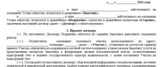
- conclusion of a contract for the implementation of work;
- performing geodetic measurements;
- obtaining a boundary plan;
- collection of documentation;
- payment of state duty;
- registration of the plan in the Unified State Register of Real Estate.
During the procedure the engineer:
- checks and studies land title documentation;
- creates a project for upcoming work;
- informs owners of neighboring territories about the procedure;
- establishes the boundaries of the allotment;
- performs the required geodetic work;
- makes a plan.
IMPORTANT! The state fee for registering a boundary plan is 350 rubles. You can pay in advance at any bank or when submitting documents on the spot.
The local authority was held accountable for the uncleaned area adjacent to the house.
In the area adjacent to the house, felled parts of trees and bushes remained. The management organization did not remove them, which is why they were brought to administrative responsibility in accordance with federal legislation and the Law on Administrative Offenses in the Samara Region.
Responsibility for such an offense is prescribed in paragraph “a” of Part 1 of Art. 4.28 of the specified local law and is expressed in an administrative fine
- for citizens – from 1,000 to 3,000 rubles;
- for officials - from 10,000 to 30,000 rubles;
- for legal entities – from 30,000 to 50,000 rubles.
Please note that the article does not apply to owners of premises in apartment buildings, the land plots under which are not formed or are formed along the boundaries of such buildings.
The decision of the collegial body was supported by the district and regional courts, and then by the deputy chairman of the regional court. They proceeded from the fact that landscaping and maintenance work in the territories adjacent to the apartment buildings is carried out by the owners of premises in such houses or a person authorized by them (clause 1, clause 11, chapter 3, section 2 of the Rules, approved by the resolution of the Head of the Samara City District dated June 10. 2008 No. 404).
In addition, according to 1 tbsp. 161 of the Housing Code of the Russian Federation, the management of an apartment building must ensure, among other things, favorable and safe living conditions for citizens and proper maintenance of common property in the apartment building. That is why the MA, as responsible for all of the above, issued an order and imposed a fine.
But the courts made premature conclusions.
Should the management authority repair driveways and sidewalks in courtyards?
378134
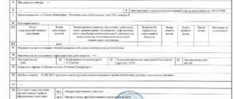
Example of a boundary plan
The plan consists of two parts: text and graphic. The first contains a table in which information about the work performed, technical parameters of the site and measurement results is entered. The second is a graphically depicted diagram of the surrounding areas.
A standard sample plan can be downloaded from this link.
The appearance of the document may vary. However, the necessary information about the work carried out and the survey results is required to be displayed.
Whether the procedure was carried out or not: study of documents
The required documents include a cadastral plan and an extract from the Unified State Register of Real Estate (cadastral passport). The definition follows the same pattern: we look for “Special Marks” and look at what is written there. In addition, there are several other aspects to consider:
- Land area. It should not be indicated precisely - this is a sign of a lack of land surveying. If the boundaries are specified, there will be a minimal error (you can find this information in section 1 in the above documents, and you can find out how much the permissible error is here).
- Description of turning points of the site boundaries (section KB6 of the cadastral plan). When the boundaries are clarified, these figures will be entered into the document.
You can find out what land surveying documents look like here.
Why do you need information about this procedure?
In connection with the new law on mandatory land surveying, this information is needed by everyone who wants to continue to be able to manage their plot. Information will also be needed in the event of disputes with neighbors regarding the boundaries of the site, the establishment of easements, etc.
Note! The land surveying procedure is regulated by the law “On the State Real Estate Cadastre”.
Next, we will tell you how to find out whether a plot of land was surveyed in different ways.
Citizens and legal entities maintain only land plots in their ownership
The Supreme Court of the Russian Federation, to which the management organization filed a complaint, noted: the company’s defenders have repeatedly informed the courts that the boundaries of the land plot adjacent to the apartment building have not been established, the site has not been specified, there is no plan diagram and there is no contrary evidence in the case. Previous authorities did not give this fact a proper legal assessment.
The right to use a land plot belongs to its owners, land users, landowners and tenants (Articles 40, 41 and 42 of the Land Code of the Russian Federation). They are entrusted with the obligation to comply with the requirements of town planning regulations, construction, environmental, sanitary and hygienic, fire safety and other rules and regulations.
Federal legislation does not require citizens and legal entities to be responsible for the condition of other territories, except for land plots in their ownership or possession (Federal Law of March 30, 1999 No. 52-FZ, Articles 37–39 of the Federal Law of January 10, 2002 No. 7-FZ).
It is possible to oblige owners, holders, and users of real estate to maintain the territory adjacent to their land plots on the basis of federal law or an agreement. This conclusion was made by the Supreme Court of the Russian Federation in paragraph 7 of the Review of Judicial Practice No. 4 (2018).
The improvement of territories that are not assigned to legal entities, individuals and individual entrepreneurs is carried out by the administration of intra-city districts of the Samara urban district. This follows paragraph 10 of Chapter. Section 3 2 Rules for improvement of the territory of the Samara urban district.
It is necessary to distinguish between the concepts of “adjacent” and “adjacent”
In the case under consideration, the management organization was held accountable for not participating in the maintenance of adjacent territories within the boundaries established in accordance with the Law of the Samara Region and the rules for landscaping the territory of the municipality.
In Art. 2 of the Law of the Samara Region dated June 13, 2018 No. 48-GD defines the concept of “adjacent territory”. This is “a public territory that is adjacent to a building, structure, structure, or land plot if such a land plot is formed, and the boundaries of which are determined by the rules for the improvement of the territory of the municipality in accordance with the procedure established by this Law.”
The Supreme Court of the Russian Federation indicated that the legal status of the disputed land plot was not established and the question of who is obliged to maintain it was not clarified. In the resolution of the collegial body and decisions of previous instances, the territory is called either adjacent or adjacent. Meanwhile, these are different concepts.
Based on this, the Supreme Court of the Russian Federation overturned the decisions of previous instances and sent the case for a new trial to the district court.
Should the management authority contain trees in the local area?
329185


