The main risks of buying a plot without land surveying
Purchasing a plot of land is a responsible matter, accompanied not only by the choice of real estate and compliance with the nuances, but also by certain risks. Even a person who understands the legal intricacies is not always able to foresee all the details of the transaction, so consultation with a specialist is recommended. The optimal solution would be to grant the right to conduct the purchase and sale of a plot to an experienced lawyer.
A land plot is real estate that is sold by individuals and legal entities, as well as city authorities. The price depends on the region where the purchase object is located, as well as on individual characteristics - location (within the city or outside it), the availability of infrastructure, the degree of preparation of documents.
The latter option provides, in particular, for the presence of site boundaries. Land can be sold either with or without a boundary, which implies the absence of certain boundaries, and the documents do not indicate a specific area.
The risks of buying a plot without land surveying are that in the future there may be problems with marking boundaries, especially if neighbors have specific complaints. If there are controversial issues, it is impossible to sell a plot without land surveying, and it is also impossible to resolve the conflict independently. The situation can only be resolved in court, which takes a lot of time and effort.
How to carry out a civil action with a plot without land surveying?
Rent
The most common property transactions with land plots are leases. The tenant has the right to act:
- municipality of the locality;
- individual and legal entity.
For tenants from among administrative bodies, a regulatory provision has been established that provides for the transfer of lease rights through public auctions.
Public auctions require cadastral registration and land surveying.
Therefore, the lands currently being acquired through participation in auctions are registered in accordance with established rules and have undergone land surveying.
To rent land from the municipality you will need:
- Go to the local administration and write an application addressed to the head of the municipality.
- In the application, indicate a request for permission to participate in the auction. Attach a copy of the applicant's civil passport.
- Wait for an invitation from the administration. After purchasing the lease right at the auction, complete the documentation.
The preparation of primary documents takes place at the administration, where the following will be issued:
- a copy of the tender protocol;
- deed of transfer of leasehold rights.
With the indicated documents, you need to go to the local branch of the multifunctional center (MFC) and write to the registrar an application with a request to register the obtained rental right. You must first pay the state fee for registration services (2,000 rubles) and present a receipt and civil passport. In a month, the copyright holder will receive a certificate of rental rights from Rosreestr.
REFERENCE. Persons with disabilities or raising disabled children have the right to receive land plots out of turn, without participating in auctions.
However, if the lessor is an individual or legal entity who has the right to lease the plots belonging to him, these requirements do not apply to him. That is, such an owner has the right to draw up a lease agreement without submitting a boundary plan. In this case, you need to proceed as follows:
- Draw up a lease agreement between the owner and the copyright holder. It is advisable to have it notarized.
- If the lease provides for a period of more than a year, the agreement must be registered with the MFC. To do this, the parties go to Rosreestr, with passports and a receipt for payment of the duty. The owner provides a cadastral passport of the plot and a certificate of the form of title.
- A month later, a certificate of tenancy is issued, which is transferred to the tenant. The rest of the documentation for the land remains with the owner.
- Responsibility for all disputes that may arise when renting a land plot without land surveying rests with the owner of the plot.
Purchase and sale
Should I buy a plot without land surveying? When buying or selling a plot without delineating the plot, responsibility and risks for the undemarcated plot are transferred to the new owner.
If the seller significantly reduces the value of the land when selling due to the lack of land surveying, the buyer may or may not gain benefits from the transaction.
The question is that it is land surveying that reveals all problems and violations, establishing reliable boundary boundaries on the ground.
Until it is carried out, unpleasant surprises are allowed to appear. If the buyer has decided to purchase such a plot, the registration algorithm is as follows:
- The parties draw up a civil contract of sale and purchase (bill of sale). It can be certified by a notary.
- After execution and signing by the parties, the agreement must be registered with the MFC. The parties pay a fee, write an application to register the property transaction and attach a package of documents.
- A month later, the buyer receives a certificate of ownership and a cadastral passport. It turns out that he bought a plot without surveying the plot and from that moment on, all responsibility for the location of the boundaries of the plot passes to him.
To complete a transaction, submit to the MFC:
- civil passports of the parties;
- 3 copies of the contract;
- the owner submits a certificate of ownership and title document;
- receipt of payment of the duty.
The absence of a cadastral passport is not an obstacle to completing the transaction.
ATTENTION! Documentation drawn up in accordance with all the rules for a property transaction for a plot without land surveying does not guarantee that the property purchased is exactly the one specified in the contract. To fix a site on the ground, it is necessary to enter into the Rosreestr information about the drawing of boundary boundaries, indicating the coordinates of turning points.
If you still decide to carry out land surveying, then it is useful for you to read about:
- what is measurement error and what is its acceptable indicator;
- what is the cost of the procedure;
- what is the procedure for agreeing boundaries;
- how to do it for free;
- where to order and who to do the procedure;
- what to do if the survey was carried out incorrectly.
Privatization
Is it possible to privatize a plot without land surveying? A procedure is provided in accordance with the regulations of the Law on Privatization, adopted on July 4, 1991 under No. 1541-1. For this:
- The owner of the plot, who is not the owner, contacts the administration of the locality and writes an application addressed to the head of the executive committee (department.
- The application indicates the location of the plot and the period of ownership. Be sure to guarantee that you have not previously participated in land privatization.
- Expresses a request for a free transfer of ownership.
- Awaiting the decision of the administrative commission, which is made at public hearings.
- A positive decision is formalized by an administrative act and transferred to the applicant for registration in Rosreestr.
The copyright holder submits a package of documentation to the registration authority, which includes a civil passport, an administrative act and a certificate:
- on the right of lifelong inheritable ownership;
- permanent (unlimited) use;
- rent.
After registration, the owner receives a certificate of ownership and is responsible for the boundaries of the site.
Since the legal owner of the transferred plot is the administration, in response to an application for privatization, it can give a reasoned refusal, with the requirement to carry out land surveying.
If privatization is refused, the administration must submit an official document with reference to legislative sources.
If the refusal is unlawful, it can be challenged in court.
What is it and general provisions
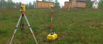
Land surveying is engineering and geodetic measures aimed at establishing the true boundaries of the site.
The following organizations have the right to carry out the procedure:
- geodetic office;
- real estate agency;
- Notarial office;
- company belonging to Rosnedvizhimost.
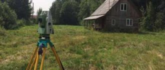
Direct surveying can only be carried out by specialists with the necessary education and a set of tools.
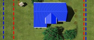
The principle is based on determining the boundaries of real estate (based on documentation for the site or a court decision). Points along the perimeter are designated by some physical objects to fix visual boundaries. Most often, wooden pegs are used, installed in the corners of the site.
Sample application for land surveying
Advantages of plots with land surveying
When conducting a geodetic survey, cadastral engineers record turning points and mark them on the plan. After such a procedure, neighbors will not be able to take even a centimeter from the land plot. In practice, the last person to carry out land surveying gets a plot smaller than the one he is currently using.
The “last dissociated” site can have a very complex configuration and take such a form that construction will be impossible. But building a house on a site in violation of fire safety clearances and SNiP is unsafe. Subsequently, it is almost impossible to register ownership of such a house and put it into operation.
The worst thing is when the boundaries are not defined and there may be a border on the contour of the house, intersecting with the red line. That is, in fact, the owner of the plot can dispose of a smaller plot than he could by surveying his plot. All these points are known to most buyers who prefer plots with land surveying.
Lawyers of AN Istrariel remind that conducting commercial transactions with land is impossible without prior land surveying. We also advise owners of previously registered plots to carry out land surveying, since buildings on such a plot cannot be alienated because they are registered with reference to the boundaries of the land plot. Cadastral engineers of AN Istrariel carry out land surveying and also correct existing cadastral errors.
Important Notes
The law does not prohibit the sale or purchase of plots without land surveying. In most cases, this practice is carried out when organizing a new residential village or dacha cooperative, where the land on paper is divided into plots, but in practice the boundaries are not marked.
When buying land without borders, you should be attentive to some things:
| Correspondence between the area of the plot in documents and in reality | This can be determined visually by visiting the object of purchase and measuring its boundaries. The extreme points of the boundary should not affect neighboring properties. |
| Location compliance | According to the documents, the site must be located at the same address. There are frequent cases of fraud when the buyer is shown one object, but the contract indicates a completely different one, which often has conflicting situations. |
| No encumbrance | It is recommended to find out for yourself whether the property is pledged or seized by bailiffs. |
It would also be a good idea to pay attention to the distribution of the boundaries of the neighboring area. If it is already delimited, then the extreme points should not touch the purchased property
. Simply put, two adjacent areas should not overlap each other.
Is it possible
The purchase and sale of plots without land surveying is not prohibited by law. The documents of such real estate do not indicate boundaries, but the owner has full right to realize it
. However, if you purchase such real estate now, in 2021 you will in any case have to go through the procedure of determining boundaries.
As a rule, areas without boundaries are common in gardening partnerships and agricultural lands. Before the sale, the owner of the property must offer to buy out his share to members of the cooperative or community
. If there are no offers from shareholders within a month, the owner can sell the land to anyone.
The sale of plots without boundaries for construction is also legal, but this requires the subsequent determination of boundaries independently. The only benefit can be in the low cost of real estate, but the risks of buying a plot without land surveying in this case are extremely high.
In particular, this applies to the construction of permanent buildings (house, garage, outbuildings). First of all, it is necessary to establish boundaries, and only then carry out construction. Otherwise, if the calculations are incorrect, the court may rule that the house was built in violation and must be demolished.
What the law says
The legislation of the Russian Federation divides land plots into different categories, therefore the standards are different for everyone.
For example, until 2021, all land real estate was subject to mandatory land surveying. These included both cooperative summer cottage plots and land owned for construction.
At the end of 2021, a “dacha amnesty” (Federal Law No. 93) was issued, which provides for optional land surveying of dacha plots and some other categories of land that were not intended for the construction of residential buildings. Federal Law No. 447 proposes to reintroduce mandatory land surveying of all land plots from 2021.
Download Federal Law No. 93 On dacha amnesty
The necessary conditions
It is impossible to carry out the land surveying procedure on your own, even if you know perfectly well the principle of its implementation. Only specialists with education and equipment are allowed to carry out work.
Based on the actions taken, the boundaries of the site are established. The data is entered into the documentation, and special signs are installed along the perimeter of the property.
Specialists include surveyors and land managers, whose responsibilities include marking the boundaries of land plots and preparing documents.
The boundaries of the land plot have not been established: is it necessary to carry out land surveying?
Many land plots do not have clearly defined legal boundaries. Current legislation does not require their owners to carry out land surveying. However, it is better to carry out this procedure, because otherwise the owner risks facing problems in the future, including the loss of a significant area of the site. How does this happen in practice? What do buyers of a plot with undefined boundaries need to know?
Says:
Ksenia Ulyanova,
senior lawyer, head of Land Law Firm practice
A land plot becomes an object of rights if it has characteristics that allow it to be defined as an individually defined thing (Clause 3, Article 6 of the Land Code of the Russian Federation). According to the current legislation, one of these characteristics is the location of its borders (Article 22 of the Federal Law of July 13, 2015 No. 218-FZ “On State Registration of Real Estate”, hereinafter referred to as Law No. 218-FZ).
The boundaries of the site can be:
- actual - these are boundaries determined by the procedure for using the object and individualized on the ground - boundaries, fences, etc.,
- legal - these are the coordinates of the characteristic points of the boundaries of the object contained in the Unified State Register of Real Estate. They are determined by the cadastral engineer during the land surveying process.
Ideally, the legal and actual boundaries of the site should coincide, but in practice this is not always the case. The fact is that not all land plots were registered in the cadastral register with the coordinates of characteristic border points indicated. The owners put up fences and only later, when the legal boundaries were clarified, did it become clear that these fences were not located at all on the border of the plots.
Legal boundaries take precedence over actual ones. Only if the documents do not contain information about the location of the boundaries of the land plot, its boundaries are considered to be boundaries that have existed on the ground for more than 15 years (clause 10 of Article 22 of Law No. 218-FZ).
KEY RULE OF MARKING
The boundaries of the plot being surveyed should not cross the boundaries of a neighboring plot of land that is already registered in the cadastral register with established boundaries.
P. 20 h. 1 tbsp. 26 of Law No. 218-FZ
Is it necessary to carry out land surveying if the boundaries of the site are not defined?
Law No. 218-FZ requires mandatory land surveying if we are talking about the formation of a new object of rights. However, this requirement applies only to legal relations that arose after January 1, 2021 (Clause 5, Article 72 of Law No. 218-FZ). That is, if now the owner of a plot with undefined boundaries wants to carry out some kind of cadastral action, for example, to divide it, he will not be able to do this without clarifying the boundaries of the original plot.
If the site has undergone cadastral or technical registration according to the rules of previously applicable legislation, there is no need to carry out cadastral registration according to the new rules. It is also not necessary to clarify the boundaries of such areas, even if information about them is not in the Unified State Register of Real Estate. Such areas are called previously recorded (Article 69 of Law No. 218-FZ).
Thus, as a general rule, land owners are not required to clarify boundaries, but can do so if they wish. To do this, the owner needs to contact a cadastral engineer to prepare a boundary plan and further register changes in the Unified State Register.
At the same time, the lack of information about the boundaries of a land plot in the Unified State Register entails a number of legal risks.
What risks does purchasing a plot with undefined boundaries entail?
Legally, the lack of coordinates of the boundaries of the site is not an obstacle to transactions.
In Art. 26 of Law No. 218-FZ lists the grounds for refusal of state registration of rights to a property. This list is exhaustive and does not contain such a basis as the absence of information about the boundaries of the land plot in the Unified State Register.
However, buyers should be wary, because the lack of boundaries may hide, in particular:
- discrepancy in area - when the buyer thinks that he is purchasing a plot of a certain area, but after determining the boundaries it turns out that its actual area is much smaller,
- disputes over boundaries with owners of adjacent plots who do not want to coordinate them,
- the purchase of actually a completely different plot - not the one that the buyer originally intended to purchase,
- purchasing a plot with foreign objects - when, after determining the boundaries, it turns out, for example, that a gas pipeline runs within the boundaries of the plot.
In such cases, the buyer may go to court with the following demands:
- recognize the contract as not concluded because its subject cannot be accurately determined, or
- invalidate the contract as concluded under the influence of a material misconception.
CASE STUDY
The company purchased a plot next to its store for entry and parking.
According to the documents, information about the location of the boundaries of this site is approximate. After the purchase, the company turned to a cadastral engineer to establish the boundaries of the acquired plot and take them out in kind. The cadastral engineer was unable to do this, since at the specified address another land plot had already been formed and registered with the cadastral register with updated boundaries. Subsequently, it was not possible to determine the actual location of the acquired site.
The company went to court with the following demands:
- recognize the contract of sale and purchase of the plot as not concluded under Art. 554 Civil Code of the Russian Federation,
- oblige the seller to return payment.
The courts declared the agreement not concluded, noting the following.
From the contents of the agreement, it is impossible to unambiguously draw a conclusion about its subject matter and determine the sale and transfer of which particular land plot the parties agreed upon, since there is no description of the location of the boundaries of the land plot. There is no data to identify the property either in the contract or in the transfer and acceptance certificate.
If the text of the contract does not indicate the exact location of the land plot (borders of the plot), or if there is no information about the boundaries of the land plot in the state real estate cadastre, the condition on the subject of the contract cannot be recognized as agreed upon by the parties, and the contract cannot be considered concluded.
Appeal ruling of the Penza Regional Court dated April 23, 2013 in case No. 33-961
Why should the owner hurry to clarify the boundaries of the site?
The most common problem in the absence of information about the boundaries of a plot in the Unified State Register of Real Estate is disputes with neighbors over the boundaries of land plots, as well as the unauthorized placement of buildings, structures, and other real estate objects on a neighboring plot of land.
It often happens that after contacting a cadastral engineer, the owner learns that the “legal” area of his property has decreased, because first of all, the boundaries of neighboring land plots already established in the Unified State Register are taken into account.
In such a situation, the neighbor who was the first to register the land plot “within the boundaries” has an advantage, since his neighbor must either agree with the existing boundary or prove his case in court. The legal process will only be promising if the neighboring plot is incorrectly registered in the cadastral register (if there is a registry error in the information about the boundaries of the land plot).
How can the owner of a plot with undefined boundaries protect his rights?
To protect their rights in a dispute over the boundaries of a site, the copyright holder needs to demand:
- fix the registry error, and
- establish the boundaries of the land plot.
If necessary, you can also submit demands for the dismantling of the fence, demolition of buildings, etc. (Definition 3KSOYU dated December 18, 2019 No. 88-1701/2019, Determination 1KSOYU dated December 4, 2019 No. 88-916/2019).
The defendant in such disputes will be the owner of the adjacent land plot. The cadastral engineer, who prepared the boundary plan of the neighboring land plot, and Rosreestr, who entered the disputed information into the Unified State Register of Real Estate, are not proper defendants.
The owner of a land plot whose boundaries are not defined must prove a violation of his right. This could be either a refusal by Rosreestr to clarify boundaries due to crossing the boundaries of adjacent land plots, or a conclusion prepared by a cadastral engineer about the impossibility of carrying out cadastral registration for the same reason.
In order to correctly determine the boundaries of adjacent land plots, the court appoints a land management examination (Resolution 10AAS dated 02/08/2018 in case No. A41-56073/16, Appeal ruling of the Moscow City Court dated 03/16/2020 in case No. 33-8974/2020).
NOTE
When conducting an examination, it is important that the expert not only confirms the presence of a registration error and incorrect land surveying, but also suggests options for where to establish new boundaries of the disputed land plots.
Otherwise, the court will not have the opportunity to restore the violated right of the plaintiff (Determination of the Supreme Court of the Russian Federation of October 15, 2019 No. 9-KG19-12, 2-62/2018). Additional evidence in favor of the plaintiff’s position may be a violation of the procedure for registering an adjacent plot of land for cadastral registration. For example, improper coordination of the boundaries of a land plot with neighbors (lack of signature in the act of coordination of boundaries).
However, this argument does not work as independent evidence. Recently, the position of the courts has emerged that the absence of a signature of an adjacent land user on the boundary approval sheet is not an absolute basis for declaring the results of cadastral work invalid. What is important is not only the fact of violation of the procedure, but also the legal consequences of such a violation - incorrect determination of the boundary (Determination 7KSOYU dated 02.25.2020 in case No. 88-3066/2020).
On a note
As a rule, the amount of tax and land rent depend on the area of the property. If the legal boundaries of the site are not defined, it is possible that its area is less than the area recorded in the register. This means that if the boundaries are not established, situations of overpayment of taxes and rent are possible.
Articles on the topic
RF Armed Forces: you can challenge red lines without applying for a construction permit
11.03.2021
1913
Land and real estate
The owners of the building, located on land leased from the state, accidentally learned that red lines were running through their building. They tried to challenge...
More details
The land plot fell into a zone with special conditions of use: is it possible to demand its purchase?
07.06.2020
15735
Land and real estate
In August 2021, a chapter appeared in the Land Code regulating zones with special conditions for the use of the territory. From now on the law...
More details
Tags: RF Armed Forces land plots land cadastral registration boundary disputes registry disputeshortrid
Problems and risks of buying a plot without land surveying
Risks that arise when purchasing a plot without land surveying can occur both during the paperwork process and after completing the procedure.
In the first option, the consequences are insignificant, since the discovery of a discrepancy between the boundaries according to the documents and in Rosreestr can serve as cancellation of the transaction without visible consequences for the buyer. In this case, it makes sense to refuse to purchase this plot or give the owner time to fix the problems.
If the plot has already been purchased, then the lack of a boundary can be the beginning of problems with neighbors. Claims to establish true boundaries and differing views on this are a common cause of litigation.
. The law provides for the responsibility for carrying out all procedures and costs for the new owner of the land plot.
In addition, the construction of a private house on such a site may lead to non-compliance with the “red line”, which is determined only after the land surveying procedure. The red line is the definition of the construction boundary from the boundaries of the site.
The court may decide to move the foundation of the house if its location does not comply with the requirements of the law. And this already implies the demolition of the building or part of it, as well as serious material costs.
Is it possible to buy?
If ownership of a plot is registered, the owner can sell it and take other actions.
To complete the transaction and enter data into Rosreestr, no additional documents are required if both parties agree and there are no claims from third parties.
At the moment, according to the law of the Russian Federation, it is possible to purchase a plot without land surveying.
However, the procedure itself is strongly recommended both by the state and by realtors and lawyers, so today the number of such transactions is declining. New plots are difficult to register or sell, but there are also many owners who received land for use many years ago.
Brief information. Until 2006, in Russia, all land was necessarily surveyed, including dacha cooperatives and plots for development by private and legal entities. Then Federal Law No. 93 was adopted, which was called the “Dacha Amnesty.” After this, landowners were freed from mandatory land surveying if the construction of large buildings was not planned.
Such plots are entered into the cadastral register on a general basis and are assigned an identification number. Data registration is a mandatory procedure to secure ownership. Such objects are entered into the Unified State Register of Real Estate with the mark “without clear boundaries.”
Today, the possibility of purchase and sale remains, although there is talk of canceling the “Dacha Amnesty” and introducing mandatory land surveying. This is due to the increased demand for land and the increase in private construction.
Main conditions of the procedure
To carry out land surveying, it is necessary to follow the current legislation, and entrust the procedure to certified specialists.
An important point is the preparation of all land surveying documents. This will avoid unpleasant consequences, and responsibility for incorrect measurements or accidental overlapping of objects will fall directly on the performers.
Form of boundary plan:
Where to go
You should contact a construction or surveying company about land surveying. Some real estate agencies selling plots can also provide their own specialists.
The owner of the site needs to ensure the qualifications of the employees and also sign an agreement for the provision of services. The document must include a clause regarding liability for incorrect measurements.
In addition, surveyors can be invited from BTI. A government organization inspires much more confidence, but you will have to wait some time if there is a waiting list for procedures.
What is the order
The land surveying procedure involves the following procedure:
- submitting an application to the appropriate organization - the owner of the site can draw up an agreement to carry out land surveying work, and also apply to government authorities with an application to independently carry out the procedure (only possible if you have the necessary education);
- specialists begin work at the specified time;
- a conclusion on the actions taken is provided to the applicant as a boundary plan;
- the owner of the site with the received technical documentation applies to the registration authorities.
The period for registering a land plot reaches up to 2 months. In practice, the time depends on how busy the organization is, the time of year and the priority.
Available actions
In the absence of the opportunity, means, and sometimes even desire to carry out the land surveying procedure, the owner can freely implement it.
Available actions for areas without boundaries include:
- sale;
- rental;
- donation;
- exchange;
- inheritance.
The owner has the right to almost all actions while the “dacha amnesty” is in effect. However, experts still recommend carrying out the land surveying procedure. This will avoid possible problems, and will also increase the price of the property when you try to sell it.
Is it worth deciding?
Everyone independently determines whether they should purchase a plot without land surveying. No one has canceled the risks associated with this type of real estate, as well as additional expenses.
It is worth buying a plot without a boundary in the following cases:
| Low cost | The buyer needs to compare the market value of the property with the formalized land surveying procedure and separately with its value. If the proposed land is cheaper, then it makes sense to buy it and establish boundaries at your own expense. |
| Neighboring plot in a dacha cooperative | Since most summer cottage properties do not have land surveying, this type of transaction carries minimal risks, especially if it is neighboring. |
| No adjacent borders | This means when a land plot is purchased in a new dacha cooperative or village, and the proposed property does not yet have neighbors. In this case, it is necessary to carry out the land surveying procedure first, excluding possible claims from neighbors. |
| No complaints from owners of neighboring plots | If a land plot is proposed with existing neighbors, then it is important that they do not have any claims regarding the boundaries. |
In any case, in 2021, all owners of summer cottages will be required to undergo a land surveying procedure, so for those for whom the acquisition is not urgent, it makes sense to wait.
Advantages and disadvantages
The positive aspects of purchasing a plot without land surveying include the following:
| Lower cost | Owners deliberately underestimate the value of real estate in order to sell it faster. As a rule, the difference is the amount that needs to be spent on land surveying work, as well as material compensation for the waste of time and effort. |
| Possibility of implementing the memory in full | At the moment, there are no restrictions on the sale or purchase of real estate without land surveying, if there are no conflict situations with neighbors. |
| Easier registration procedure | The package of documents excludes data on the boundaries of the site. |
The disadvantages include:
- all sorts of risks associated with a smaller actual area than stated in the documents;
- possible conflict situations with neighbors and government agencies if data does not match;
- spending from personal savings on the land surveying procedure;
- the need to undergo the procedure in 2021 is mandatory.
If the plot does not have an extremely attractive price or a convenient location for the buyer, it is not recommended to purchase a land plot without land surveying. Potential risks and obligatory costs in the future are not comparable with the benefits received.
The land plot is assessed by a cadastral engineer.
Is it possible to buy and sell a plot of land by proxy? We will tell you in this article.
Is the consent of the spouses required for the sale of a land plot? Read on.
Is it necessary to survey plots in SNT?
The boundary plan guarantees a number of advantages. But it will require physical and financial investments. Gardeners prefer to take a break on this issue. Some people hope “maybe” and believe that it will be possible to do without the procedure. After all, it does not affect productivity and the absence of parasites. And when land surveying becomes necessary, they think they will cope with the task. And the laws are written in such a way that there is no excitement around the topic yet. But there are tens of millions of owners in the country. If everyone brings documents on the same day, then the work of Rosreestr will be paralyzed.
One way or another, problems will have to be solved someday. Beam and garlic will be able to grow without land surveying. If the neighbors do not behave impudently, then land surveying can be carried out in a few years. Perhaps in the future something will be simplified, new amendments will be invented.
You will have to get down to business immediately when changing or transferring ownership of property. If the land does not have boundaries defined by law, then it cannot be bequeathed, sold, or given away. This norm came into force in the winter of 2021!
Government structures do not pursue an active policy in terms of urgent land surveying and bringing documents into compliance with legal norms. Reality suggests that in the Russian Federation there are a lot of properties that are not listed in the register. People use such land, but do not make any contributions to the budget.
Land surveying will help resolve a number of current problems of owners. We are talking about old real estate holdings. Documentary registration of land at the same time forces the registration of dilapidated buildings. The cadastral engineer will not only determine the boundaries of the site, but will also record the area of the immovable property and link the house or barn to the site.
Quite often, during the process of holding events, errors are found in the planning of buildings. Sometimes the documents incorrectly indicate fences, enclosures, and small buildings. The work of a cadastral engineer will make it possible to unify the papers of the entire SNT. All individual drawings will be consolidated into one document. Sometimes the procedure allows you to identify errors and unaccounted areas of land.
It is believed that land surveying is accompanied by disputes with neighbors. But in fact, when performing his duties, the engineer will definitely carry out coordination with the owners of adjacent plots in the format of an act.
Experience has shown that disputes between neighbors are not the worst thing. Some SNTs over the years of existence have gone beyond their limits, there are reasons for this:
- When cutting the earth, outdated technology was used; pegs were driven in approximately. The reference to real coordinates was relative.
- In the process of land use, some owners gradually independently seized new territories.
The land surveying procedure will help eliminate all inaccuracies. Many will have to explain the erroneous location of the fence. If there are no adjacent claimants to the territory, provision is made for an adequate increase in the legal land. The permissible increase in the plot is 10%. Everything else will need to be returned to the state fund. The fence or fence must be moved to the line designated by the engineer.
Buying a plot without land surveying. What are the risks?
The question “is it possible to buy a plot without land surveying?” is no less relevant than “is it really possible to sell a plot for which there is no boundary plan?” Let's look at both of them
. The article also provides instructions for purchasing such a plot and a description of the risks of this procedure.
The Land Code states that you can sell real estate that meets the following requirements:
- not encumbered with collateral,
- the owner has title documents,
- is privatized.
A prerequisite is the registration of the purchase and sale agreement with the MFC. If there are several owners, written consent of each is required for the sale of the land plot.
Important! The law does not prohibit the sale of land plots on which land surveying has not been carried out, so it is possible to buy a plot without land surveying.
To register a land plot for cadastral registration, it is not necessary to carry out the land surveying procedure (for example, it was registered under the dacha amnesty). If the plot is included in the unified state register of real estate, it can be manipulated:
- rent out
- include in a will
- exchange for other property,
- donate
- carry out purchase and sale.
Now we will take a closer look at the procedure for purchasing a plot of land where land surveying has not been carried out.
What actions are available with a site without land surveying?
Is it possible to sell a plot of land without land surveying? A land plot registered in the cadastral register, in accordance with the norms of the Federal Law on the State Real Estate Cadastre (GKN), dated July 24, 2007 No. 221-FZ, is allowed for a number of civil actions, regardless of the availability of documentation for land surveying.
Among the civil relations that are allowed with such an allotment:
- purchase and sale, barter, donation;
- inheritance;
- rental;
- re-registration of ownership.
Such a wide range of procedures with a plot is allowed due to the provisions of the Law “On Dacha Amnesty”, which simplified the procedure for registering plots.
This document was valid until 2015.
Currently, it continues to be applied in some regions, on the basis of extension through the adoption of regional or local acts.
At the same time, some regions have abolished the “dacha amnesty” and are demanding the restoration of order in the land masses.
IMPORTANT! Regardless of the position of the administration of the locality, a property transaction with a plot that has not undergone land surveying should not encounter legal obstacles.
However, these transactions tend to involve risk, which is entirely the responsibility of the copyright holder.
Purchasing process
In addition to answering the question of whether it is possible to buy a plot without land surveying, those interested in purchasing land need to know how to correctly carry out the purchase procedure so as not to encounter problems in the future.
- Drawing up a purchase and sale agreement (for security, the document can be certified by a notary).
- Registration of the agreement at the MFC - you will need to fill out a corresponding application and pay the state fee.
- Waiting for the issuance of a cadastral plan and a certificate of ownership of real estate.
Note! Certificates of ownership are no longer issued; this document can be used instead (it is an alternative to a certificate with legal force, i.e. it proves ownership of the property)
It is necessary to dwell in more detail on the registration of the purchase and sale transaction.
Purchase risks, possible consequences and problems
Buying a plot without land surveying has risks; as a rule, they are associated with the boundaries of the land. Since there is no boundary plan agreed upon with the owners of neighboring plots, on which the coordinate points of the boundaries of the land plot are marked, neighbors may make claims regarding the topographic location of the boundaries. This will not be revealed immediately, but when the new owner decides to carry out land surveying
.
More information about how boundaries are coordinated and what rights the owners of neighboring plots have can be read in the article: “Demarcation of a land plot without the consent of neighbors.”
Buying a plot without land surveying is only at first glance a profitable deal (usually such plots are sold at a reduced price), because in the future, when trying to carry out land surveying, the owner may face financial problems. It is possible that the former owner could not carry out land surveying due to the fact that he could not agree on the boundaries of the plot with the neighbors, so he sells it (along with the current problems).
HOW TO KNOW IF THE EARTH HAS BOUNDARIES
Typically, owners believe that if there is a fence, then this is the border. But only those information about boundaries that are entered in the Unified State Register are considered legally significant.
How can I find out if the boundaries of a land plot are included there? You need to obtain an extract from the Unified State Register of Real Estate about the main characteristics and registered rights to the property. If the register does not contain the necessary information about boundaries, the extract will contain a special o.
You can obtain an extract using electronic services on the website of Rosreestr, the Federal Cadastral Chamber of Rosreestr or on the website of State Services.
Rosreestr also has a useful reference service “Public Cadastral Map”. It looks like an interactive map with information about areas throughout Russia. The easiest way to find a specific object on it is by the address or cadastral number of the land plot. If o appears in the description window, it means that no boundaries have been set.
Privatization of the site
Since the answer to the question “is it possible to buy a plot of land without land surveying?” positive, many citizens think that it is also possible to buy a non-privatized land plot (this misconception is due to the fact that land surveying is done for privatization, and if it is not necessary, then privatization is supposedly not necessary).
Privatization of real estate is a condition for the implementation of a purchase and sale transaction. It is in the interests of the seller to oblige the owner of the land plot to privatize it (this does not require land surveying). Purchasing non-privatized real estate is an illegal enterprise; such a transaction cannot be notarized and formalized at the MFC .
Having the title documents in hand, the owner must write an application for privatization, in which he indicates the property, the period of ownership and provides evidence that he has not previously used the right to privatization. The municipal authority will consider the application and issue an administrative act (will approve the application for privatization without a boundary plan)
. Approval of an application depends on two factors:
- whether the plot is covered by the dacha amnesty;
- Is privatization allowed in the region without land surveying?
In many regions of the Russian Federation, the land surveying procedure is mandatory for registering ownership of real estate.
Next, the owner needs to contact the Cadastral Chamber, provide a civil passport, a decision of the municipal authorities to authorize the privatization of the site, and an extract from the Unified State Register of Real Estate. Upon completion of the operation, the citizen will become the full owner of the land and will be able to sell it.
Is it possible to conduct real estate transactions?
Real estate, including plots of land under a house or undeveloped plots intended for various purposes, are allowed to participate in property transactions.
The basic requirements for conducting property transactions are as follows:
- Real estate must be registered as ownership through privatization or have title and title documentation obtained as a result of a previous property transaction.
- The property must not be encumbered with collateral.
- If a land plot or other object is jointly owned, joint participation in the transaction or the provision of a notarized power of attorney is required.
- The transaction is formalized by an official civil law agreement and requires registration in a multifunctional center (MFC) or a local branch of Rosreestr.
As practice shows, this regulation does not include a requirement for mandatory land surveying, provided that the plot of land is registered in the cadastral register (we wrote about the connection between the cadastre and land surveying here). It turns out that the questions of whether it is possible to sell land without surveying and whether it is possible to buy a plot of land without surveying can be answered unequivocally - yes.
REFERENCE. When registering a transaction in Rosreestr, the submission of a land survey file is also not required if the site is included in the registration information.
Summing up: advice to buyers
The purchase and sale of land without land surveying is a legal procedure. There are not very many buyers for such property, because citizens understand the consequences of purchasing such land. The article contains enough information to warn readers against making a rash purchase.
.
Advice: if you are interested in a plot without land surveying, try to convince the seller to carry out the procedure for clarifying the boundaries. As a last resort, you can conclude a preliminary purchase and sale agreement, which sets out the condition that you undertake to sign the main agreement immediately after the owner carries out land surveying
.
The document can also indicate that the costs of the cadastral engineer’s services will be paid by the buyer
.
If the seller refuses such an offer, you can be sure that everything is not simple with the land plot and it is not profitable to buy it
.
Risks of purchasing a plot without land surveying (probability) in 2021
The risks of buying a plot without land surveying may lie in subsequent problems with neighbors. If they want to mark territorial boundaries
. If there is a desire to sell this object to another person, the transaction may not take place. In any case, you will need to carry out land surveying and seek the services of a geodetic company, and this is also not free.
What is it and general provisions
Land surveying is a mandatory procedure for legalizing property, selling and conducting other transactions. What does this give? And the fact that not a single neighbor can, by “mistake,” occupy several hectares of land and also install a fence
.
Therefore, to prevent this from happening, they install the last points of the territorial border, draw up and install a fence
. All! Now you can freely dispose of the object. Sell, donate, and so on.
Who to contact : notary, realtor, geodetic organization. They can carry out similar procedures. But only a certified specialist with a set of the required tools to carry out accurate calculations can engage in land surveying.
Important notes when purchasing a plot without boundaries
The law does not prohibit the sale of real estate without clearly defining boundaries. Especially when it comes to the construction of a new residential complex or dacha cooperative
. The site is simply divided into several zones, but without legal registration.
You should pay attention to the following things:
- Check documents for data compliance. To do this, you will definitely need to go to the site. Having measured the object, compare the obtained data with those recorded in the cadastral documents
. If there is a clear discrepancy, ask the owner to comment on what he will say. - Compliance with location. Fraudsters hone their skills on each client
.
And in order not to fall for their tricks, you should check the address
.
It also happens that the documentation indicates one address of the site, but the buyer is invited in a different way
. If the same is true here, it is better to immediately abandon this object. - Check the presence/absence of onerous acts. To get a large loan, people turn to a financial credit organization
. And everything would be fine, but in the overwhelming majority of “black” realtors manage to sell problem areas to citizens who openly trust people without thinking about tricks on their part.
If you like the plot and are happy with everything, but there is no land surveying, you can buy it. When you draw up a purchase and sale agreement with the seller, be sure to check the presence of the clause
.
It must indicate: the seller will pay money for the purchase after the owner has carried out land surveying
. After completing this, you can proceed to the subsequent steps, register ownership and close the deal.
It is not recommended to carry out construction work on the site due to the lack of clear boundaries. There is a high probability that the red line of the site will be violated. And when completing the documents, the administration will oblige you to move the foundation to another place, or completely demolish the building
. This is where you can suffer greater losses than simply purchasing it.
Main conditions of the procedure
In order for everything to go without a single incident, it is necessary to invite a surveyor from a trusted company to carry out land surveying, and entrust the collection and preparation of documents to a certified lawyer. And everyone will mind their own business.
The survey plan is prepared on the basis of a contract. Concluded with the owner of the land plot
.
The boundary plan form can also be obtained electronically
.
If a paper copy is fundamentally required, this condition must be stated in the contractual agreement. Therefore, before moving on to close cooperation with this specialist, make sure of his career guidance
. He must have the appropriate documents.