A plot can be formed after division, connection, redistribution, allocation of an allotment from municipal or state land. When registering the right of ownership of a real estate property, you need to register a postal address in order to register the site with the cadastral register. Citizens often ask how to get an address for a plot of land? The registration process can be completed through an individual application to the authorized body and on the electronic portal of State Services.
How to assign?
Most often, an address must be assigned to new land plots. In this case, a new land plot may appear in the following cases:
- a new one was formed as a result of allocation from lands that are owned by a municipality or the state;
- consolidation of existing sites.
- separated from the existing one;
- division into two new properties. Here you need to distinguish between a section and a section.
When selecting, the existing area is preserved, its boundaries are changed, and the address is assigned only to the new (selected) area. And during the division, two new sections are formed, and addresses will be required for both.
The emergence of a new property requires its inclusion in the register. This means that such a site should have:
- cadastral number;
- boundaries;
- address.
List of documents
The general list required to obtain an address consists of:
- cadastral passport;
- documents confirming the rights of the owner.
This is a general list that can be supplemented in individual situations.
This list is not mandatory. Since all this information is already contained in government agencies, they can request it themselves. But if you want to speed up the process, it is better to attach all the documents.
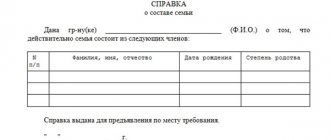
Statement
This is the main document on the basis of which the process of assigning an address to a site is initiated. Its form is officially approved and, in accordance with the requirements, the applicant must indicate the following data in it:
- details of the authority to which he applies to assign an address;
- his request to assign an address is voiced;
- detailed information about the site to which an address must be assigned: its cadastral number, other information;
- the reason for the formation of a new site, which is the basis for the need to assign a new address;
- a list of documents that are attached to the application;
- the manner in which the applicant wants to obtain a decision;
- the applicant must also sign the application with his own hand and decipher his signature.
Deadlines
The application usually indicates how the applicant wants to know about the decision. And now government authorities provide information in one of three ways:
- Email . The statutory period for consideration of the application is 18 days from the date of receipt of the documents. Therefore, an email with a decision should arrive on the 19th day;
- on paper is provided within ten days after the expiration of the time allotted for consideration of the application;
- Personally , in this case, the deadline for submission is the same as when receiving a response by email.
Refusal
But failures are possible. Most often this happens in the following cases:
- Refusal to accept documents.
Most often this happens if the package of documents is not provided in full. Another reason for refusing to accept documents may be doubts that the documents provided are reliable. This can happen if there are corrections or erasures in the documents.
- The application must be submitted by the owner personally; if this is done by an unauthorized person, then he must have a document certifying his authority.
- A refusal may also occur if the address cannot be provided.
What is it and in what cases is it needed?
Any plot of land must have its own address. This provision is enshrined in the Civil Code, which states that land is the private property of an individual and belongs to him legally. Only in this case a person receives the right of ownership and will be able to use the object at his own discretion.
In order for an individual to have this right, the plot is subject to state registration on the basis of Federal Law No. 218-FZ dated July 13, 2015 “On State Registration of Real Estate.” As part of this procedure, an address is assigned to the land plot.
From a legal point of view, an address is a set of characteristics that allow an object to be identified. Characteristics include alphabetic and/or numerical designations of the geographical location of the land plot. Also, the USRN must contain the relevant information.
Individual cases
Two storage units at one address
Such cases do not occur very often, and occur due to an error by the cadastral engineer. Also, in the past, such cases occurred when allocating plots, when settlements did not have urban planning plans, and the municipal architect could make a mistake.
To clarify this situation, a person will have to order an examination. Such an examination can be carried out by any organization that is involved in the formation of land surveying cases, in particular it can be BTI. After you have carried out an examination and clarified the existing information, you can contact the cadastral chamber to assign an address to one specific plot - yours.
It should be immediately clarified
that finding another plot at your address does not make it your property. Ownership is determined on the basis of title documents, and the coincidence of addresses is not listed among such grounds in the legislation.
The building address does not match the building address
Such cases are also rare, but they do occur in practice, and usually this is also a mistake by engineers.
The procedure is the same as in the previous situation: an examination is required, differences are established and an appeal to the cadastral chamber is required to update the information.
In both cases, if, as a result of clarifications, the address of the site was changed, and the old address is indicated in the title documents, the information will need to be changed in Rosreestr (which will make the certificate invalid).
When they can refuse
If it is not the owner of the site who applies for the assignment of an address, but another person who does not have the authority to do this on behalf of the owner, the local administration will refuse to issue a resolution.
Alexander Vasiliev
Lawyer
Another reason for refusal may be inaccurate boundaries of the land plot, due to which specialists of the registration service cannot unambiguously determine its location, or the lack of documents on land surveying. In this case, it will first be necessary to carry out cadastral work to clarify the boundaries. This can be done by hiring a cadastral engineer who will carry out work on the ground and prepare documents for entering data on the updated boundaries into the information of Rosreestr.
Public information
Knowing the address, you can find out the following information about the site:
- its cadastral number;
- situational plan;
- cadastral value;
- information about boundaries;
- owner information.
Using an address to clarify this information is the easiest and fastest way. Especially if the documents are not in front of one’s eyes, a person can always give the address with confidence. And below we will look at ways to obtain the necessary information for each case.
Cadastral number
Clarification of the cadastral number is the most common request that a person may need. In general, this number is in the cadastral passport, but this document is always kept at home with a bunch of similar documents, and in some cases there is a need to quickly clarify the number.
And in this case, you can use the Rosreestr website to obtain this information.
In general, of course, you can use other methods: a personal visit to Rosreestr, an application by mail. But clarifying the number in such ways looks somewhat absurd, especially if you can come home and look at it in your passport. But such methods may be necessary if you do not have a cadastral passport in your hands.
So, to quickly obtain information about the cadastral number, we recommend using an online service where you only need to enter the address of the land plot.
This information is for informational purposes only and such a certificate is not an official document.
Situational plan
This is a document that contains not only the land plot itself, but also other data, for example:
- nearby buildings, including an indication of the number of floors in them;
- names of surrounding streets;
- cardinal directions;
- lighting data;
- data on the passage of engineering communications.
Such a plan may be needed if a transaction is being finalized or any types of work are planned. Therefore, the situation plan is available to everyone on a public map on the Internet. To do this, it is enough to know the address. This information is also provided on the Rosreestr website.
Cadastral value
The cadastral value is usually required in order to estimate the approximate amount of property tax. Also, the cadastral value can be correlated with the market value in order to more accurately determine the price of sale or purchase of a land plot.
And this information is also freely available; to obtain this information, you just need to use the same service as to obtain a cadastral number.
With this method of obtaining information, information can be obtained almost instantly and for free.
Location and boundaries
The boundaries are usually reflected in the situational plan, and they are also included in the public cadastral map on the Internet.
To obtain information, just enter the cadastral number or address, and the system will show it on the map.
The results are shown through several publicly available maps - satellite map, Yandex or Google map, or in Google satellite data. For any of the results, you can check the box to show the cadastral boundaries of the plots. This will be enough to know the boundaries. On the map they are usually drawn with red lines.
Owner
Ownership information can also be obtained like any other publicly available information about the property. Such data can be obtained in the same ways as the cadastral number or value. Information about the owner is indicated in the extract from the Unified State Register. In order to get acquainted, an electronic request via the Internet will be enough. If the document is needed to be submitted to authorities and institutions, you will need to receive a response on paper, with a stamp and signature.
In this case, only the last name, first name and patronymic will be indicated. Passport data is personal information and is protected from viewing by the legislation of the Russian Federation.
The address of a land plot is an important and integral part of it, which is required for its identification. Also, the address, along with other information about the site, allows you to consider it as an object of property, and so it can act as an object of various legal relations.
Knowing the address of the site, you can obtain information about the cadastral value or the owner. This is necessary in order to calculate the approximate amount of tax or clarify information about the encumbrance.
Legislative regulation
Decree of the Government of the Russian Federation No. 1221 of November 19, 2014 defines the general rules for the assignment, liquidation, and change of addresses. The issue is under the jurisdiction of municipalities and regional authorities. Each subject of the Russian Federation has its own rules, but there is a general procedure used by everyone without exception.
In Moscow, the procedure is regulated by Moscow Government Decree No. 58 of February 26, 2016. A specific list of requirements and application format for submission for consideration are established.
Where to submit documents
Addresses for objects are assigned by the department of architecture and urban planning under the administration of the municipality. It may have a different name from the one given, since each settlement independently resolves this issue.
You can get the necessary information about opening hours and reception days on the administration website: even for small municipalities, official online pages have been developed.
For example, in Moscow, the City Property Department is authorized to assign an address with the involvement of the BTI or district administrations.
The Moscow region and other regions have their own laws and regulations, but even there you should contact the settlement architecture departments.
Here is the address and telephone number of the Moscow Committee for Architecture and Urban Planning, where you can contact a single window and get advice on your issue.
In the video below, a professional lawyer will explain the procedure for obtaining an address.
Resolution on assigning an address to a land plot
The resolution in question is an individual administrative document that contains all the address information about the plot of land. A duly certified copy must be handed over to the owner.
What should be specified in the resolution:
- name of the authority that issued it;
- date of compilation and number;
- basis for making a decision;
- established address;
- determination of the time of entry into force of the resolution.
Changing the name of this document, for example, an act, a certificate, and so on, is not allowed by the legislator.
Was the Recording helpful? No 26 out of 31 readers found this post helpful.