Information about a property may change over time for various reasons. It is advisable to reflect such changes in the cadastre. Otherwise, the contradictions that arise may become an obstacle to transactions and other manipulations with real estate, or greatly complicate their completion, as well as negatively affect the implementation of other rights of the owner.
For example, a citizen changed the type of permitted use of his land plot and did not make changes to the cadastre. The tax inspectorate will not recalculate the amount of land tax (including downward) until the cadastre contains information about a new type of use of the land plot.
What is real estate cadastral registration? Why is it needed?
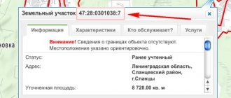
Accounting for changes in real estate is carried out by a specially authorized body that collects, stores and provides information about any real estate of Russian citizens. The work of the information base is organized using identifiers - unique cadastral numbers that are issued when entering information on the formation of a real estate property. Further, using the cadastral number, Rosreestr employees can find all the information about real estate, and publicly available information is provided on the Rosreestr website for access by any citizens, which is essentially analogous to receiving an extract from the Unified State Register.
The second important element of cadastral registration in Russia can be considered a cadastral passport. In fact, it is an extract from the state cadastre (information database). Data on real estate objects gets there after technical examinations, measurements by cadastral engineers, as well as after submission of documents from owners or authorized representatives. Changes to the real estate cadastre are made when citizens receive an extract, if the statute of limitations on the information received has expired, or inconsistencies are identified in the information received and available. A re-inspection of the property by cadastral engineers may also be scheduled to obtain accurate measurements.
There are cadastral passports in three forms:
- Cadastral extract for the land plot;
- Cadastral passport of residential or non-residential real estate;
- Cadastral extract for an object where work is still underway (that is, objects not put into operation or objects under construction).
How to identify a prohibited twin site for providing extracts from the Unified State Register of Real Estate
On April 30, 2021, Federal Law No. 120-FZ dated April 30, 2021 came into force, which amended Federal Law No. 218-FZ dated July 13, 2015. According to Part 24 of Art. 62 No. 218-FZ, extracts received by authorities, legal entities or citizens cannot be resold. Also, No. 120-FZ prohibited the creation of separate sites and applications through which you can access information from the Unified State Register of Real Estate (Part 25, Article 62 No. 218-FZ).
Rosreestr carries out comprehensive work to counter the activities of such sites. In the first half of 2021, 53 twin sites of Rosreestr were blocked, and another 25 cases of termination of the functioning of such resources were filed in the courts. Compared to 2021, the number of agency twin sites decreased by 77%.
Rosreestr has issued clarifications on how citizens and legal entities can determine that they are facing a duplicate site:
- Pay attention to the site's domain name.
The domain name of the official website of Rosreestr is www.rosreestr.gov.ru. Often, duplicate sites post information about the authority to act on behalf of Rosreestr and the Federal Cadastral Chamber. They copy the structure of official websites, use names similar to the official names of departments in their addresses, and add double letters and postscripts to them.
- Check if registration is possible through State Services.
If you cannot register in your personal account on the website through the State Services portal, then it has nothing to do with Rosreestr. On the department’s websites, an individual or legal entity can log in through the ESIA.
- Evaluate the availability of advertising.
As the department notes, twin websites of Rosreestr and the Federal Cadastral Chamber, as a rule, contain links to various mobile applications not related to Rosreestr, payment methods, as well as advertising. There are no advertisements or third-party information on the official websites of Rosreestr and FKP.
Six changes to legal acts in the field of registration of rights to real estate and land
What information is contained in the cadastral passport, and which can be changed?
The list of information to be entered about the property depends on the properties and characteristics of the property, as well as the standards provided for by law. Most often the following are included in the cadastral passport for residential real estate:
- Date of entering information into the State Property Committee;
- Object type – house, apartment, plot, unfinished building, structure;
- Unique assigned cadastral number;
- If this is an apartment building - the layout of the apartment on the floor, its layout;
- Property area;
- Information about copyright holders;
- The resulting assessment of the cadastral value of real estate (for calculating taxes);
- Are there any restrictions or encumbrances on the said property?
Most often, it is necessary to make changes to the cadastral passport of non-residential premises or residential real estate due to the following reasons:
- Clarification of information in the State Committee for Taxation;
- Changing incorrect or untrue information;
- Change of layout;
- Change of copyright holder;
- Imposition of encumbrances.
What information is entered into the State Property Committee for land plots?
In relation to land plots, the reasons for taking such actions are: change in cadastral value, configuration and/or area, name of the object, address or location, appearance or disappearance of a water body on the site, any natural plantings, change of land category or type of permitted use , the occurrence of restrictions on the property rights of the owner of the site. The most common reason for appeals are changes in configuration and area (division of plots, consolidation, redistribution, etc.), which are identified during the registration of dacha plots. Changing the category of land is another common reason for contacting a cadastral engineer. For many families, the right to convert an agricultural plot into a construction site becomes a good opportunity to improve their living conditions.
What documents are required to make changes to the cadastral passport?
- Technical passport from BTI;
- If the technical characteristics of the property have changed, a conclusion from the cadastral engineer who inspected the property may be required;
- Passport of a citizen of the Russian Federation;
- Title documents;
- Court decisions, independent expert opinions (if any).
To obtain an exact list of required documents, you must contact one of the following organizations:
- Multifunctional center in Moscow;
- Cadastre and Registration Center "Star-Service";
- Territorial office of Rosreestr;
- Bureau of Technical Inventory.
Some BTI services require payment, and only after providing a receipt, cadastral engineers will agree with you on the time of the inspection.
Algorithm for contacting the BTI:
- Preliminary consultation on amending the cadastral passport;
- Payment for BTI services (if required);
- Contact the BTI with a written statement, a receipt and a statement of the essence of your problem.
On the appointed day, cadastral engineers will come to you and carry out the necessary examinations or measurements.
To check whether changes have been made correctly, you can order a cadastral passport online, which will already contain new information.
How to correct errors in a land document?
Let's take a closer look at how to do this correctly.
Often inaccuracies are found in the cadastral passport. Errors are divided into two types: technical and cadastral.
- Technical errors are inaccuracies between the electronic database of the cadastral chamber and cadastre documents that are in the archive. Most often, errors mean incorrect numbers, grammatical errors, etc. The chamber itself is responsible for these errors, since they were made through its fault.
- Cadastral (registry) errors are inaccuracies provided to the cadastre in the form of the documents themselves. This is a boundary plan, technical plan and any other document provided to the chamber. That is, here the information in the cadastral file corresponds to the information in the electronic register. But the problem is that the data is initially incorrect.
Errors include:
- incorrectly set boundaries;
- incorrectly indicated area;
- cadastral value and others.
The cadastral engineer is most often to blame for the errors themselves.
One of the features when correcting errors is that a technical error can be corrected at your request, at the request of the cadastral chamber, or by a court decision.
The cadastral error itself will not be corrected by the cadastre , since there are only two grounds: according to your application and a court decision. This nuance is not very good because it may take several years, or even more, before you notice the error. The whole point is that it is very important to notice the error in time, otherwise, for example, you will pay more land tax (if the cadastral error relates to this aspect).
The owner most often finds these errors when:
- deregistration of land;
- making changes to the cadastral passport;
- obtaining a cadastral passport (extract from the Unified State Register of Real Estate);
- establishing easements, etc.
Attention! Correcting these errors is necessary, since you will not be able to fully manage the land.
Technical inaccuracies
There are three options in total:
- By court decision.
- Application by the owner or another person.
- On the initiative of the cadastre.
By court decision
Most often, the reason for going to court is:
- Protest of the land owner against the position of the cadastral authorities regarding the correction of technical errors at the request of third parties - neighbors, government agencies.
- The land owner's disagreement with the cadastral registration authority's refusal to correct technical errors.
In such cases, the applicant may file a claim regarding the inaction of officials, state/municipal bodies or to appeal their actions.
Such court cases have their own characteristics:
- the claim can be filed in an arbitration court or in a court of general jurisdiction;
- if the plaintiff challenges a decision made by the CMO, a claim can be filed no later than 3 months from the date of this decision;
- Only the territorial CMO can act as a defendant.
After a positive decision, the court automatically sends the resolution to the CMO for execution by employees of the cadastral authority . If for any reason the judicial act did not reach the cadastral chamber, you can present a copy of the court decision with a standard free-form application.
Reference! After receiving a court order, the decision is executed by the responsible authority within a week.
If they ignore a court order, cadastral service employees face Article 315 of the Criminal Code of the Russian Federation and a 100 thousand ruble fine.
At the request of the owner or another person
If an error is corrected on an application, the process is similar to what we described above. Typically, an application is submitted by the owner in the event that the boundaries of his property are violated during land surveying without reason or notice. This situation occurs if the land plot was registered in the old-style cadastre before 2008. To correct the situation, it is necessary to carry out the survey again.
The application is submitted by the interested party in the form described in the order of the Ministry of Economic Development of the Russian Federation No. 125, to the MFC or local CMO.
There are also 3 options for submitting an application:
- through the State Services website;
- landline mail;
- personal presence.
You need to write a statement about the detected error and attach evidence (for example, a land survey plan). This procedure is free.
After this, you need to wait 5 days and receive a corrected cadastral passport. You will receive a notification about this by landline or email. If you are refused, no notification is sent.
You don’t have time to stand in line, but do you need to obtain a cadastral passport? Our article will tell you how to get it online!
On the initiative of the cadastre
If, during an internal audit, the cadastral service independently finds an inaccuracy, then the rules for eliminating it are as follows:
- Within 5 days after finding an inaccuracy, a decision is made to correct it, and the cadastral record is brought into actual compliance.
- The next day after the decision is issued, a copy of the internal order and the current cadastral passport are sent to the owner.
Having received the letter, the owner can challenge the actions of the cadastral service in court .
Cadastral inaccuracies
There are only two options: at the initiative of the owner and by a court decision. Unlike technical ones, a cadastral institution has the right to independently correct cadastral errors only in cases of miscalculations in land surveying.
Correction procedure at the initiative of the owner
There are only 3 options for submitting an application:
- through the State Services website;
- landline mail;
- personal presence.
Procedure:
- First, you must prepare corrected documents that caused the cadastral (registry) error.
- Then you write an application and receive a receipt. The procedure is free, you do not need to pay anything. After 10 days, if the decision is positive, you will receive your new cadastral passport.
By court decision
The most common reasons for going to court in the presence of cadastral errors are the following situations :
- during land management work, the engineer discovered a cadastral error and prepared a corresponding conclusion;
- the owner is denied a cadastral passport and the property is not registered;
- the owner of the property had already submitted an application to correct the cadastral error, but this was denied.
Reference! After completion of the process, the court ruling is sent to the participants in the case within 3-5 days. The cadastral service must comply with the order or suspend cadastral registration for 3 months.
The suspension should also be appealed in court, and if evaded, contact the supervisory authority.
What problems do citizens face when making changes to cadastral passports?
- Lack of legal knowledge - the procedure for making changes to the cadastral passport may take too much time, since mistakes are made, documents have an expiration date, and the requirements of government agencies may be incorrectly interpreted.
- Lawful or unlawful refusal to make changes to the cadastral passport;
- Waste of time obtaining unnecessary examinations, opinions, permits and other documents as a result of the lack of a clear legal position.
To quickly make changes to the cadastral registration of a land plot, apartment or house, enlist the support of experienced lawyers from , who have thousands of successfully completed applications from residents of Moscow and the Moscow region.
Why is it dangerous to use the services of Rosreestr duplicate sites?
The agency warns the population and legal entities to use the services of such sites: most often they directly violate the legislation on personal data. According to Rosreestr, the copyright holders of “doubles” are individuals from the USA, the European Union and Ukraine.
By using the services of such sites, a person provides personal data “in violation of the law for the systematization, storage, accumulation and transfer of personal data to the jurisdictions of other countries of the world.” In this case, Rosreestr is not responsible for the processing of personal data transferred to duplicate sites.
The cost of services offered on duplicate sites is usually higher than that officially approved by Rosreestr and the Federal Cadastral Chamber, and the quality is not guaranteed. Rosreestr is responsible for the information provided, and duplicate sites may provide irrelevant, false information or not provide the service at all.
Important in the procedure for changing boundaries
Changing the boundaries of a land plot has its own characteristics, which consist in the following two ways:
- Without making adjustments to the area of the territory. It involves drawing boundary lines on the ground with clarification of all turning angles without shifting the sides of the site. There may be some redistribution of land plots with a shift, during which the area of the plot remains the same. In this case, the boundaries can move both in length and width.
- With a change in area. This is possible when merging, dividing, or allocating a separate share of the plot. As a result, after the boundaries are changed, a new area of the territory will appear. In some cases, one area is divided into two or three parts. This usually happens when controversial issues arise between the heirs of a share or local area. In the case of the allocation of a certain share, the plot from which a certain area was removed remains the main one, and the new one (share) is considered secondary.
Please note that a change in the boundaries of a land plot can be ordered by the direct owner or a person who is dissatisfied with the seizure of the area. This can be either an individual or a legal entity.
Boundary measurements should be carried out exclusively by professionals in the field of geodesy Source 2gis.ru
Changing boundaries after surveying
The question often arises of how to change the boundaries of a land plot after land surveying. This is possible in several cases: if the deadline established by law has passed or there are dissatisfied persons, or land survey documents were signed without their consent.
At the same time, no one except the owner can make a repeated application to the geodetic company. The owner will only need to provide evidence that the boundary change procedure is necessary. Find out what the justification may be in the section above.
The boundaries of a rectangular area on paper are highlighted with a red line if they were measured again Source: measurezemzem.rf
What to do if the land is owned, but there are no boundaries
It happens that a plot of land becomes owned by inheritance or a gift agreement. This outcome is possible due to the influence of various factors: loss of documents, incorrect transfer of ownership of the territory.
The owned plot should not remain without borders; it will then be impossible to sell it Source geroj-nashego-vremeni.ru
Such a phenomenon is a reason to urgently contact a geodetic company to put the site in order. After all, without precise boundaries, it is not possible to sell it, pass it on by inheritance and do other manipulations.
Important! In such a situation, there is a risk that the land surveying procedure will take more than 6 months.
Land surveying is also carried out for the purpose of correct installation of fences Source geomergroup.ru
If a body of water is found on the site during land surveying, it must be included in the plan Source estvaind.ru


