To check the property you can order a report
*or you can also order a report WhatsApp +79232492328 or Email
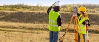
Sometimes situations arise when you need to find a cadastral engineer who carried out land management work on a land plot. You need to clarify something, talk, ask a few questions in order to understand a specific situation.
And in order to find out information about the cadastral engineer who carried out the land survey, you just need to access the Internet. Now let's figure out how to do this.
Search online by cadastral number
How to find out if a land plot is being surveyed via the Internet (online)? To do this, we need a cadastral plan, which can be viewed on the Public Cadastral Map .
- Let's use the official resource. A map of the Russian Federation opens before us. At the top left we see a column with different icons; to start the search you need to select the icon with a magnifying glass on it. Next to it there is a window in which “Land” is indicated, scroll through and find “Borders”.
- Now go to the input window and write the address or cadastral number.
- After entering the address, a tab will open with information about the land plot, including the cadastral plan.
- To familiarize yourself with it in detail, there will be an icon at the bottom of the tab; clicking on it will take you to viewing. If the site has not undergone land surveying, there will be no plan for it, and the brief information about the allotment will not indicate the name of the cadastral engineer who was responsible for determining the boundaries (you can find out how this procedure is carried out here).
There is another way - creating a request online on the Rosreestr website . We go to the Internet resource:
- Scroll to the inscription “Electronic services and services”.
- Click “Go to section”.
- A tab will open with .
- In the form you need to indicate the address of the object.
- Click “Generate request”.
After this, you will be given information about the requested object, including information about whether land surveying was carried out or not, if it is present on the map.
If the previous options did not work, you can make an online cadastral extract .
- Visit the Rosreestr website.
- There will be three sections:
- for individuals;
- for legal entities;
- specialists.
- You select the section of a legal entity or an individual (depending on which category you belong to).
- You will see a page with a column “Electronic services”. You click on the very first “Receiving information from the Unified State Register of Real Estate” and you will immediately see a form to fill out.
- On the right there will be a section “Public services”, you select item 6 under the account “Get a cadastral plan from the territory of the Unified State Register of Real Estate”.
- Fill in all the fields: cadastral number and landmarks of the territory.
- Just below, select the type of receipt of the statement (it can be written or electronic).
- After selecting the type of statement, enter your email to receive an electronic one and the actual one to receive a paper one.
- Next, a window will open to check the above data. Check if there are any errors in the information you provided and click on “Submit Request”.
- After this, expect an email containing all the information for payment for the statement:
- application number;
- payment code;
- code at the end of the letter.
- Please note that the payment link will be at the end of the received email. By clicking on this link you will be taken to the “Check Request Status” page. On this page, enter the payment code from the email.
- Next, you will be taken to the payment page, where you need to select the appropriate payment method. There are such options as: payment terminal, bank card, QIWI wallet.
- Pay for the electronic version 50 rubles for individuals, 300 rubles for legal entities.
- Expect 5-10 days to receive your statement.
Having this document in paper or electronic form, you need to pay attention to the “Special Notes”. If there is no land surveying, it will be written that the boundaries have not been established or have been established, but conditionally.
If the “Special Marks” indicate the new and old cadastral numbers, or other information confirming the establishment of boundaries, then land surveying has been carried out.
We wrote in this article about whether it is necessary to do land surveying if you have a cadastral number and a passport for the allotment, but you can find out why to set boundaries if you have a certificate of ownership here.
Legislation
Issues of the need for land surveying are considered in laws No. 122-FZ of July 21, 1997, No. 93-FZ of June 30, 2006 (On the dacha amnesty), No. 221-FZ of July 24, 2007 “On the State Cadastre”.
Some provisions of the articles of laws were clarified by Law No. 447-FZ of December 21, 2014. In particular, according to it, from January 1, 2018, land plots that have imprecise boundaries will not be registered.
The same law addresses issues of carrying out activities for complex cadastral work, which includes boundary work.
Visit to the MFC or Rosreestr
The source of obtaining data on the presence of land surveying is a cadastral passport or cadastral extract. Accordingly, you need to contact us to prepare these documents.
Let's consider the procedure for obtaining:
- We go to the MFC or Rosreestr branch.
- We submit an application (below you can download a sample application form for a cadastral passport) containing:
- your personal information (Last name, first name, patronymic, passport details, residential address, email, mobile phone);
option for receiving a cadastral plan: in person, by mail, by e-mail;
- your signature.
- You wait 10 days.
- Having received it, we immediately look for “Special Marks” and look at what is indicated there (are the boundaries defined or not). This way we will understand whether the boundaries of the site have been clarified (you can find out how to find out the boundaries of the site yourself here).
Don't forget to attach your passport or power of attorney if you are a proxy.
What information can you find out about a cadastral engineer?
In fact, you can officially find out quite a lot of information about CIs, including:
- name - full name.
- Number and date of issue of the qualification certificate.
- Registration number in the register of cadastral engineers.
- Which SRO does he belong to? SRO is a self-regulatory organization.
- SNILS – insurance number of an individual personal account.
- TIN – individual tax number.
- Education information.
- Postal address for contacting the cadastral engineer.
- Work and mobile phones.
- Email for communication.
- Place of work (organization in which CI works).
- Information about the insurance company that insured the CI’s activities and for what amount.
- Number of complaints filed against CI activities.
- Information on inspections of CI activities.
- Number of penalties.
- CI status – valid or not.
Whether the procedure was carried out or not: study of documents
The required documents include a cadastral plan and an extract from the Unified State Register of Real Estate (cadastral passport). The definition follows the same pattern: we look for “Special Marks” and look at what is written there. In addition, there are several other aspects to consider:
- Land area. It should not be indicated precisely - this is a sign of a lack of land surveying. If the boundaries are specified, there will be a minimal error (you can find this information in section 1 in the above documents, and you can find out how much the permissible error is here).
- Description of turning points of the site boundaries (section KB6 of the cadastral plan). When the boundaries are clarified, these figures will be entered into the document.
You can find out what land surveying documents look like here.
By what date should the land survey be completed?
It is especially important to ask the question of whether land surveying was done for owners of plots whose cadastral passports (extracts from the Unified State Register of Real Estate) were issued without this operation.
In addition, everyone who plans to donate, bequeath, or sell their plots in 2021 needs to know about the availability of land surveying. Find out whether it is possible to sell a plot or part, buy it and privatize it without land surveying here.
This is supported by Federal Law No. 447.
Documentation
Preparatory steps for the procedure include:
- identifying the boundaries of the site, taking into account title documents;
- request for data from the State Property Committee for plots (certificate of restrictions, copy from the General Plan);
- verification/analysis of information from the land registry;
- informing neighbors about land surveying (in writing).
In order to determine the exact coordinates of the site , the owner provides:
- identification document/power of attorney for the person representing his interests;
- documents of a title nature (certificate of ownership, agreement on purchase and sale, donation, court decision, will, acts of municipal authorities on the allocation (provision) of land);
- documentation of a technical nature (cadastral plan/extract, certificate from the BTI, copy of a plot, cadastral plan of a property located on the land or a certificate of absence of buildings);
- a document confirming the presence/absence of encumbrances;
- application of the established form.
- extract from the Unified State Register of Individual Entrepreneurs.
The cadastral passport is not attached to this list.
All documents must be submitted in originals . If the specified information is inconsistent/contradictory, it is necessary to make adjustments, after which you can begin the land surveying procedure.
It is recommended to order technical documentation in advance from the territorial divisions of the BTI in order to speed up the process of obtaining a boundary plan.
If the applicant is a legal entity, then an additional list of documents will be required (power of attorney to represent interests from a company/institution, certificate of state registration/tax registration, charter of a commercial structure).
The need for land surveying if you have a cadastral passport
The need for land surveying is indicated in Articles 19 and 20 of Law No. 122-FZ. It says that if such a land plot does not have data on the coordinates of its borders, the state registration of the land plot may be suspended or denied.
However, there are also exceptions to this rule . These include the following cases:
- the plot is given for gardening, vegetable gardening, as well as for the construction of a garage or individual housing construction;
- the plot was previously registered in accordance with the established procedure and the owner has title documents;
- the right to ownership of the share of the land plot is registered;
- the right to a land plot arises upon the re-registration of perpetual use into ownership.
The above exceptions will cease to apply as of January 1, 2018 (Law No. 447-FZ).
That is, from the beginning of 2021, registration or re-registration of all land plots will have to be carried out taking into account the presence of land surveying.
In addition, any transactions (for example, purchase and sale, collateral, donation) with land plots that have a cadastral passport and number, but have not received land surveying, will be impossible to carry out.
In general, the need for land surveying for land plots that have a cadastral passport depends on two reasons:
- transactions that the owner is going to make with the land plot;
- the time of these transactions (until December 31, 2017 or later).
If the owner does not intend to make any transactions with his land plot, then it is not necessary to carry out land surveying. Moreover, the land surveying process is quite expensive. If the owner intends to carry out any transactions with land plots (purchase and sale, donation, inheritance) after 2021, then he will have to carry out land surveying.
When conducting transactions in 2021, land surveying is not mandatory, but in this case it is necessary to take into account that the participant in the transaction (for example, the buyer), if he wishes to subsequently make a transaction with the purchased plot, will still be forced to carry out land surveying.
In some cases, when selling a plot in 2021, it is also advisable to carry out land surveying. This may be required in the following circumstances:
- if the actual area of the land plot turns out to be less than the declared one, then this fact must be legalized in order not to pay extra land tax;
- if the actual area of the land plot exceeds the area declared in the documents, then this fact must be legitimized by land surveying;
- to clarify the boundaries of the plot for sale and prevent disputes with neighbors;
- when selling a share of a storage unit.
In other cases, when the owner of the land plot, who has a cadastral passport, has no intention of making any transactions with the land plot and there are no disputes with neighbors along the boundaries of the land plot, land surveying may not be carried out.
Consultation on services, terms, costs
Leave a request right now and get a free consultation from our specialists.
· Carrying out cuttings to the ground. The configuration of a land plot takes a long time to form. Therefore, sometimes there are surpluses or, on the contrary, parts are allocated to neighbors. Naturally, land tax will be calculated based on the declared area. If in fact your plot is smaller than that indicated in the declaration, then you will pay more.
· Division of the site. The reasons for division may vary. For example, some want to give a share to children, others to sell the share to regular people. If there was no land surveying, then the division cannot be performed.
Having analyzed the norms of current legislation and assessed the risks, experts came to the unequivocal conclusion that land surveying should be carried out. And it’s worth doing this even if you don’t plan to carry out any legal transactions with your land in the near future.