The combination of two landholdings into a single plot is available only to their legal owners. To do this, it is necessary to carry out certain cadastral work, after which the newly formed plot should be registered in the cadastral register and registered with the Rosreestr authorities. But is this possible provided that the plots that need to be combined have different cadastral numbers?
What is land consolidation
Formed land tenure is characterized by certain characteristics - established boundaries, size, category and type of permitted land use. The specified information is available for any plot, which makes it possible to identify them among lands with similar characteristics.
Land consolidation is a legal event that has its own distinctive features:
- in the process of unification, the original plots cease to exist separately, and the newly formed plots are endowed with uniform boundaries;
- the consolidation of land is possible both for one owner of two plots, and for different owners (the latter case involves registering a new land plot as common shared ownership);
- When the procedure is completed, the plots retain their category and type of permitted land use.
The merger of neighboring territories is possible exclusively for their owners. If you are using adjacent lands on a leasehold basis, in order to combine them, contact the owner of the plots to obtain permits and prepare other necessary papers.
Most often, situations arise in which two neighboring plots that are the property of one person are combined. In such circumstances, distribution of shares in the newly formed plot is not required; they are provided as the property of the sole owner.
Options for combining plots
A consolidated plot may have two owners who own the property in shares. This fact must be documented after completing the relevant documents.
If a person does not own a plot of land by right of ownership, then a merger can also be carried out. To do this, it is necessary to coordinate all actions with municipal authorities.
In some cases, it is possible to carry out operations with a land plot:
- if it has become a lifelong use;
- allocated on the terms of free fixed-term use;
- transferred for indefinite permanent use.
It is also possible to combine several land plots if they have the same purpose and are located nearby (within one locality). After the merger procedure, a single territory is obtained, which the owner can dispose of without restrictions.
Conditions for combining land plots
The provisions of land legislation indicate various situations in which a cadastral specialist can carry out the association of land holdings.
Before you begin preparing the papers necessary for this procedure, find out in advance whether your situation relates to those listed by the legislator:
- plots are characterized by the same type of permitted land use and belong to the same category. This means that, for example, it is possible to connect plots intended for gardening or provided for agriculture;
- As an essential point, the legislator highlights the need for the merged plots to belong to a single entity or territorial entity (city, village, other populated areas). Thus, if three plots are located within the Novosibirsk region, then there will be no difficulties. And if one section is located in Novosibirsk, and the rest are in Kuibyshev, then connecting such sections is impossible;
- a significant limitation is that the parameters of the created plot must meet the maximum size requirements. Typically, the subjects of our state independently establish these standards, and some municipalities do not provide for restrictions at all;
- turning points must be set clearly according to standards. This implies that it is not possible to connect lands located within, for example, water and forest zones. Merging is possible only for areas with turning points and established boundaries, data about which is contained in the Unified State Register of Real Estate;
- lands that are in perpetual use or lifetime inheritable ownership must be exploited by one person.
Is it possible to combine two land plots with different cadastral numbers?
If we consider this issue from a legal position, then the connection of plots is certain cadastral work, the result of which is the registration of at least two neighboring plots into a single object subject to cadastral registration. This is established by the norms of the Land Code of the Russian Federation.
The legislator allows the implementation of these measures in relation to lands with different unique numbers, since after the formation of a new land tenure it will be assigned a new number according to the cadastre.
Where to go to merge two land plots with different cadastral numbers
Cadastral registration and registration of rights in relation to a newly formed plot are possible in various ways.
It could be:
- appeal to Rosreestr;
- submission of necessary papers to the MFC;
- visiting the land resources committee;
- filing an application electronically using the government services portal.
Any of the above options involves submitting a standard set of papers, the list of which is fixed by the provisions of Federal Law No. 218-FZ.
How to combine land plots with different cadastral numbers
The connection of two landholdings that have different cadastral numbers occurs in the following sequence:
- preparation process. Make sure that the collected land ownership documents are properly completed. Also carefully check the information recorded in the state real estate cadastre with the land plan data. Taking into account the information thus established, check the correct location of land boundaries. If you find discrepancies, surveying work will be required;
- appearance before the authorized bodies to sign an agreement on the consolidation of land by the participants in the procedure. Submit a statement about the need for the event;
- after the agreement is signed, the cadastral engineer begins preparing the survey file, which must be certified by the applicant and submitted to the competent authorities for verification;
- The end of the event is accompanied by the receipt of a cadastral passport. It is usually produced within five days. With the prepared documents, visit the Rosreestr authority or a multifunctional center in order to register ownership of the land obtained as a result of the merger.
The newly created plot is assigned an address. In order to reduce time costs, start obtaining the address of the land when the cadastral work is completed, and the site itself has not yet undergone the cadastral registration procedure. This way, you will not need to provide separate documentation for address assignment.
How to combine two sections into one?
Read about the merger of two land plots belonging to the same owner here.
How to get help from a lawyer on land issues, read the link:
Our lawyers know the answer to your question
Free legal advice by phone: in Moscow and the Moscow region, in St. Petersburg, as well as throughout Russia
The land survey record records all the data about the newly created site, and you should know the following nuances regarding it:
- The new plot is assigned a new number (cadastral). Numbers assigned to previously existing sites are removed by representatives of Rosreestr;
- All data on plots that existed before the merger are deleted from the state register;
- All actions taken with real estate are confirmed by a certain extract, which is received by the owners or owner of the land plot.
As soon as the Rosreestr service issues an extract to the property owner, the procedure for merging the plots is considered completed.
The unification process may have some difficulties at the initial stage. First of all, this applies to plots that are located in a collective garden (GNT). As a rule, the lands located in such partnerships do not belong to each owner, but are the property of the owner of the SNT, who distributed the shares between the participants of the partnership. In order to unite dacha plots in SNT, it is necessary first of all to privatize the land, or, if the plot was received before October 30, 2001, take advantage of the “dacha amnesty”, and then follow the step-by-step instructions for merging the plots.
Documents for combining land plots with different cadastral numbers
The list of papers required to unite territories consists of:
- title and title documents for the merged landholdings;
- lease agreements, permission issued by the lessor to carry out this procedure;
- land survey, which is drawn up by a cadastral specialist;
- documents identifying the owners of neighboring plots;
- completed applications for registration of land ownership in the cadastral register and its registration;
- payment document for state duty.
All listed papers required in order to unite neighboring landholdings must be submitted to Rosreestr in original copies.
Application for consolidation of land plots
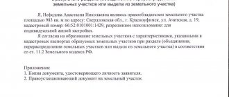
Before starting the land consolidation procedure, take certain actions. First, submit a completed application for consolidation of allotments. The applicant can be either the sole owner of the merging plots or several owners in the case where objects belonging to different persons are combined. In the application for the association of land holdings, provide your personal information, including passport details, place of registration and contact telephone number.
In general, the essence of the application is a request to issue a permit or other act on the possibility of unifying land.
Write down information about the size of the plots, their unique numbers according to the cadastre, the intended purpose and the estimated address of the newly formed plot with the designated land use purposes at the end of the procedure.
In the list of attachments, list the papers you have on hand. As a rule, this is your identification document, the original power of attorney (if you represent the interests of the owner), a document on registration of a person as an individual entrepreneur (if there is one), documents that are the basis for the emergence of rights to land ownership, cadastral passports, extracts from the Unified State Register for neighboring plots, diagrams of their location in the form of draft boundaries. Similar documents are also necessary for preparing a land survey regarding the connection of land boundaries.
However, this is possible only after submitting an application regarding the unification of lands and checking the accuracy and correctness of the documents provided for the objects. As a result of the procedure, a resolution is issued allowing the merger of the two plots.
Do not forget also that, along with applications for land consolidation and state registration, you have the right to submit an application for registration of the transfer of ownership or its termination in relation to plots in your property. In such circumstances, the transfer or termination of rights to previously existing plots occurs together with the registration of rights to the newly formed land ownership.
The Anapa department of the Rosreestr Office for the Krasnodar Territory explains: As a result of the merger of two or more land plots, a new land plot is formed with the same intended purpose and permitted use as the original plots. In this case, the original land plots cease to exist from the date of state registration of ownership of the new land plot. When merging land plots, the owner of the original plots acquires ownership rights to the resulting land plot. If the original plots belonged to several owners, then they have the right of common ownership to the resulting plot. The formation of a new plot by combining land plots belonging to several owners is carried out by agreement between them. If one of the land plots being merged is encumbered with a pledge, then the right of pledge will extend to the entire formed plot, unless otherwise established by agreement of the parties. To combine privately owned land plots, the following actions must be taken: 1. It is necessary to make sure that the land plots belong to the same category of land and have the same type of permitted use. This information is indicated in the certificate of state registration of rights, issued before July 15, 2016, or in an extract from the Unified State Register of Real Estate, certifying the state registration of rights to real estate. If the merged land plots have a different category and (or) type of permitted use, it is necessary to transfer them to one category and one type of permitted use. At the same stage, it is necessary to calculate whether the newly formed land plot will exceed the maximum permissible plot size, which is established by local legislation. It is also necessary to clarify that the combination of plots is actually possible if they are located in the same territorial zone and in the same locality. 2. It is necessary to contact a cadastral engineer to carry out land surveying of the merged land plots. Land surveying is work to establish the boundaries of land plots on the ground, securing such boundaries with boundary signs and describing their location. To carry out land surveying, you need to obtain an act of approval of the location of the boundaries of the land plot with neighbors, who must be properly notified of such approval. If the location of the boundaries of several adjacent land plots is simultaneously clarified, then the number of approval acts must correspond to the number of such plots. The cadastral engineer will establish the boundaries of the resulting land plot and draw up a boundary plan. The contract for the performance of cadastral works may provide for the obligation of the cadastral engineer to place the boundary plan prepared by him in an electronic storage facility, which is maintained by the rights registration authority. 3. It is necessary to prepare documents and pay the state fee. For cadastral registration and registration of property rights, in particular, the following documents will be required: - application for state cadastral registration and state registration; — agreement between owners on the merger of plots; — title documents for the original land plots, if the right to the plots was not previously registered in the Unified State Register of Real Estate. If the boundary plan is placed in electronic storage, the identifying number of the boundary plan can be indicated in the application. In this case, its presentation will not be required. When submitting an application in person, the applicant presents a passport, and his representative - a passport and a notarized power of attorney confirming his authority. For state registration of ownership of a newly formed land plot, it is necessary to pay a state fee. Submission of a document confirming payment of the state fee along with the application is not required. The applicant has the right to do this on his own initiative. However, if there is no information about the payment of the state duty in the State Information System on state and municipal payments, after five days from the date of filing the application, Rosreestr will return the application and the documents attached to it without consideration. 4. It is necessary to submit documents to Rosreestr. The application and the necessary documents are submitted by the applicant to Rosreestr in one of the following ways: 1. directly to the Rosreestr branch or through the MFC (regardless of the location of the property according to the list of divisions that accept on an extraterritorial basis posted on the Rosreestr website) or to an authorized person of Rosreestr when visiting reception 2. by post with a declared value when forwarding it, a list of the contents and a notification of delivery (in this case, the authenticity of the signature on the application must be notarized, the agreement and power of attorney of the representative must be notarized, and copies of identification documents must be attached); 3. in the form of electronic documents via the Internet, for example, through the official website of Rosreestr. If at the time of submission of the application the state duty has not been paid, the applicant is issued or sent information containing a unique payment identifier (unique accrual identifier) necessary to confirm the fact of payment for a specific service for payment of the state duty, indicating the date by which it must be paid. Simultaneously with cadastral registration and state registration of ownership of the new plot, deregistration will be carried out and the termination of rights to the original land plots will be registered. After the specified period, the applicant receives an extract from the Unified State Register, which can be sent electronically.
Decision on consolidation of land plots
The best option in this case can be considered to obtain a decision regarding the merger of landholdings, which will allow you to become the owner of a single plot, instead of owning several. If you own two plots, then one, the area of which is equal to one, their market value will be less than in the case of a single object. In this case, you will not need to collect a package of documentation twice for each plot and pay land tax for each of them.
A decision made by local authorities regarding the consolidation of landholdings requires state registration of rights to the newly formed land plot.
Together with the procedure for registering rights to the created plot, registration of restrictions or encumbrances also occurs, even if they are established in relation to only one of the plots to be merged.
If the registration of the right to one of the connected plots was not carried out, this cannot be a reason for refusing registration actions in relation to the land ownership being formed, if there is a document authorizing the merger of territories.
It is also possible that certain situations, provided for by the legislator, may arise in which, together with the procedure for registering land ownership rights after the connection, restrictions and encumbrances are removed, but in this case it is always necessary to consider the specific situation by a qualified specialist dealing with land issues.
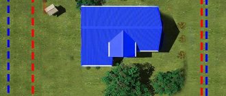
Determining the boundaries of the future site: who to contact?
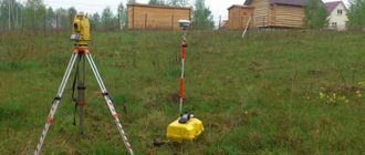
To determine the boundaries of the site, you need to carry out land surveying or cadastral survey.
Both processes are fast and not very expensive. After completing these operations, you are provided with documents that contain official evidence of the size, geometry and topography of the site.
Direct communication on the topic will be carried out with a cadastral engineer - this is a specialist who will explain to you all the intricacies of the procedure and announce the price.
Cost and terms
Depending on weather conditions, season, queue for work, region, the price can range from 5,000 to 15,000 rubles. Even in the worst case scenario, the procedure will not take more than two weeks.
Boundary plan for combining land plots
Registration of the boundary plan occurs as a result of the procedure for merging plots in the bodies carrying out cadastral registration. Its volume is equal to that required to complete the registration of a newly formed site; the document necessarily contains all the sections required by specially developed Rules for its registration.
The boundary plan for the unification of land holdings must display unique cadastre numbers assigned to the merging plots, explanatory documentation contains the address of the land holding, an overview or situational plan regarding the boundaries of the territory, indicating the numbers identifying the object, according to the form of registration of the state register of land holdings of the corresponding territory, serves as a visual explanation.
Cadastral registration is carried out immediately after a decision is made to unite lands into one plot.
In order to obtain boundary plans for the consolidation of land, participants in the procedure must have a decision allowing the consolidation of plots, issued by the relevant competent authority disposing of land property.
The adoption and production of a decision occurs through the issuance of a resolution allowing the execution of the procedure. Prepare in advance an agreement on the connection of plots, which is drawn up in writing, in relation to the lands of their sole owner, or an agreement concluded between several owners who want to combine the lands.
In order to submit an application for the production of a survey document, prepare a set of appropriate documentation, consisting of:
- documents providing the basis for the emergence of the rights of a single or several owners to landholdings and buildings erected on their territory;
- technical passports for sites prepared by the BTI authorities (if any);
- copies of identification documents of the applicant(s);
- extracts from the Unified State Register of Land Owners for the connected landholdings;
- topographical plans for plots, which reflect the red line and protected areas (if any).
Algorithm for combining land holdings
The first step towards achieving the intended goal will be to carry out boundary work on the territory or territories, if such operations have not been carried out previously. Land surveying can only be performed by a licensed specialist from a company that has membership in a specialized SRO. Land surveying cannot be carried out without organizing a series of geodetic surveys on the ground, so the contractor’s visit to the site is inevitable. It is unacceptable to carry out such measurements on your own, since the specialist operates with modern satellite equipment. In addition, data provided by a non-licensed professional will not have minimal legal effect.
Conducted geodetic surveys allow the engineer to collect information to establish characteristic points of land ownership and determine the exact boundaries of the territory. The result of his professional activities will be the preparation of a boundary plan for the unification of lands. This document is prepared taking into account the requirements fixed by legislators that are relevant at the time of organizing the events.
Consolidation of adjacent landholdings implies:
- Formation of a boundary plan for a new real estate property;
- Carrying out the necessary cadastral activities on the ground;
- Registration of the united territory with the State Property Committee.
Legislative acts provide for certain features applicable to the areas being merged:
- The data regarding the new site entered into the GKN database is of a temporary nature.
- The encumbrances that existed for the plots participating in the merger remain in force in relation to the new object.
- The territory being formed must be assigned an address. If it does not yet exist, information about the exact location of the land is reflected in the GKN database.
For applicants, the issue of assigning a postal address to a new site remains relevant. It is most convenient to solve the problem after all cadastral activities are completed, but before the territory is registered with the State Property Committee. This will significantly reduce the time spent on paperwork. If during the specified time period the landowner was not involved in resolving the issue of assigning an address, then he can begin these activities later, at a convenient time.
The merger procedure is considered completed when the landowner or landowners formalize their property rights in relation to the new real estate property. This is impossible without going through the state registration of property rights procedure, during which the applicant receives documents confirming his rights to the area. As soon as state registration is completed, information regarding previous sites contained in the State Property Committee database will acquire archival status.
The union is available only for territories with clearly defined boundaries and characteristic points. The procedure is the responsibility of a licensed cadastral engineer. The result of his professional activities will be the preparation of an up-to-date version of the boundary plan for the real estate being created.
Resolution on the consolidation of land plots
In the resolution issued after the approval of the specified measure in relation to the connection of land holdings, the main point is the procedure for assigning an address to the newly formed plot by local authorities. This occurs after the submitted application for land consolidation and the documentation attached to it are considered within the period established by the legislator from the date of receipt of the relevant papers.
The first step in the local administration is the preparation of a draft resolution regarding the consolidation of plots, with further consideration of this topic at a meeting of the commission formed to regulate land legal relations by local authorities.
The specified draft document on the consolidation of land, developed by the relevant administration, implies a mandatory procedure for coordination with the chief architect of the municipality with the submission of a document authorizing the consolidation of plots and a prepared land survey plan for connecting the territories.
After the commission regulating land legal relations makes a decision on the possibility of combining real estate, the issue is considered at a meeting of the administration, as a result of which a resolution is issued regarding the combination of plots, signed by the head of this administration.
If the decision is not made in your favor, you will be notified in writing, indicating the grounds for refusal to complete the procedure.
Either way, you will receive written notice within seven days of the date the decision to refuse was made. The resolution on the unification of land holdings is issued by an appropriate person authorized by the administration at a personal reception.
If you do not agree with the decision made, you can appeal the actions of the authorized person in accordance with the requirements of the current legislation, including by filing an application with a judicial authority.
Subtleties of land unification
When starting the process, the interests of third parties should be taken into account. If your land is mortgaged or encumbered by a court decision, then you will not be able to freely dispose of it.
The status of the encumbrance may be transferred to the united land plot if you have not agreed on an exception with the participant of this encumbrance. All agreements should be documented.
Do not forget that renting a land plot by a third party also requires agreement on all conditions. If the leased area is participating in a consolidation, you must obtain the tenant's written consent to the consolidation.
Although such an operation also has its advantages. Given that the land being merged has at least one common boundary, the owners are not required to notify neighbors about the operation.
When faced with certain nuances in the preparation of documents, contact competent specialists. Lawyers will help you fill out the paperwork correctly and take into account all the nuances associated with the legal status of the new land plot.
For example, in some cases, land consolidation may be irrational and prevent the construction of new facilities or the use of land for its intended purpose. In this case, the authorities will most likely not issue a positive decision.